IMAGES TAKEN NEAR TO
Walkden Road, MANCHESTER, M28 2QT

Introduction

This page details the photographs taken nearby to Walkden Road, M28 2QT by members of the Geograph project.

The Geograph project started in 2005 with the aim of publishing, organising and preserving representative images for every square kilometre of Great Britain, Ireland and the Isle of Man.

There are currently over 7.5m images from over14,400 individuals and you can help contribute to the project by visiting https://www.geograph.org.uk

Image Map


Images are licensed for reuse under creativecommons.org/licenses/by-sa/2.0
Notes
  • Clicking on the map will re-center to the selected point.
  • The higher the marker number, the further away the image location is from the centre of the postcode.

Image Listing (10 Images Found)

Images are licensed for reuse under creativecommons.org/licenses/by-sa/2.0
Image
Details
Distance
1
Worsley Old Hall
Worsley Old Hall is a historic mansion converted in to a leading, up-market gastropub, and is located in the northern part of Worsley in Greater Manchester.
Image: © Steven Haslington Taken: 20 Feb 2016
0.00 miles
2
Worsley Old Hall
Image: © Anthony Parkes Taken: 7 Feb 2017
0.01 miles
3
Worsley Old Hall
Public house and restaurant in a former house. Grade II listed and dating from the 16th century.
Image: © Graham Hogg Taken: 12 Mar 2016
0.02 miles
4
Worsley Old Hall
Image: © Anthony Parkes Taken: 7 Feb 2017
0.02 miles
5
The Mews - Worsley
Image: © Anthony Parkes Taken: 30 Jan 2019
0.12 miles
6
The third tee
On the Marriott Worsley Park Golf Club
Image: © Graham Hogg Taken: 12 Mar 2016
0.17 miles
7
A575 at Worsley Park Hotel
Image: © Colin Pyle Taken: 3 Oct 2015
0.17 miles
8
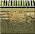
Old Boundary Marker on Old Hall Lane, Worsley
Boundary Marker in the entrance to Lady Hill House on the south side of Old Hall Lane 20 metres west of the junction with the A575 Walkden Road. In the former Worsley parish. Recorded as one of five place name stones around Worsley in a document of City Boundary Stones. There is no evidence of Ladyhill being a township or parish. Greater Manchester Historic Environment Record says it is a Plague Stone. It may just be the name of the house and doesn’t look very old. Milestone Society National ID: LA_LADH01bm
Image: © C Leather Taken: 17 Aug 2024
0.19 miles
9
Disused Cold War Operations Bunker, Middlewood
Image: © Anthony Parkes Taken: 1 Mar 2004
0.21 miles
10
Worsley - Anti-Aircraft Operations Room (AAOR)
The AAOR was completed in 1952 and was manned by the British Army, Royal Artillery. The nuclear bunker was used to control the Anti-Aircraft guns of the Manchester Gun Defended Area (GDA), which were intended to shoot down Soviet bombers carrying atomic weapons during the Cold War. The AAOR was obsolete by 1958 when the Royal Navy took it over as a food stores depot until 1961.
Image: © Saul Beeson Taken: 10 Nov 2005
0.21 miles