IMAGES TAKEN NEAR TO
Walter Street, MANCHESTER, M26 4JE
Introduction
This page details the photographs taken nearby to Walter Street, M26 4JE by members of the Geograph project.
The Geograph project started in 2005 with the aim of publishing, organising and preserving representative images for every square kilometre of Great Britain, Ireland and the Isle of Man.

There are currently over 7.5m images from over14,400 individuals and you can help contribute to the project by visiting https://www.geograph.org.uk
Image Map
Images are licensed for reuse under creativecommons.org/licenses/by-sa/2.0
Notes
- Clicking on the map will re-center to the selected point.
- The higher the marker number, the further away the image location is from the centre of the postcode.
Image Listing (57 Images Found)
Images are licensed for reuse under creativecommons.org/licenses/by-sa/2.0
Image
Details
Distance
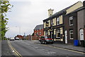
2
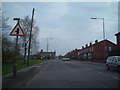
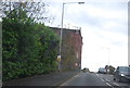
Higher Ainsworth Road
Looking SE along the B6292, with the junction of Grindsbrook Rd ahead on the left.
Image: © Colin Pyle
Taken: 23 Apr 2007
0.05 miles
5
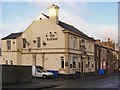
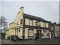
The Railway
The Railway public house on Ainsworth Road, Radcliffe.
Image: © David Dixon
Taken: 28 Jan 2010
0.08 miles
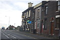
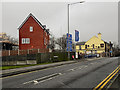
7
The Railway pub, Radcliffe
Named from the former Bury to Bolton railway which passed under the road here.
Image: © Bill Boaden
Taken: 19 May 2012
0.09 miles
8
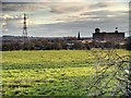
New Housing Development, Black Lane
New houses being built on the route of the former Liverpool and Bury (later Lancashire and Yorkshire) Railway where it crosses Ainsworth Road, near to the site of the former Black Lane Station.
The Liverpool and Bury Railway was formed in 1845. In 1847, it was incorporated into the Lancashire and Yorkshire Railway and from 1922, until nationalisation, was part of the London, Midland and Scottish Railway.
The line between Bolton and Bury was closed in 1970 and part of the route is now a footpath although it has been built over in other places, such as here.
http://www.lyrs.org.uk/the_railway/ - The Lancashire and Yorkshire Railway Society
http://en.wikipedia.org/wiki/Lancashire_and_Yorkshire_Railway - L&YR article on Wikipedia
Image: © David Dixon
Taken: 6 Jan 2012
0.11 miles