IMAGES TAKEN NEAR TO
Rectory Grove, MANCHESTER, M25 1DF
Introduction
This page details the photographs taken nearby to Rectory Grove, M25 1DF by members of the Geograph project.
The Geograph project started in 2005 with the aim of publishing, organising and preserving representative images for every square kilometre of Great Britain, Ireland and the Isle of Man.

There are currently over 7.5m images from over14,400 individuals and you can help contribute to the project by visiting https://www.geograph.org.uk
Image Map
Images are licensed for reuse under creativecommons.org/licenses/by-sa/2.0
Notes
- Clicking on the map will re-center to the selected point.
- The higher the marker number, the further away the image location is from the centre of the postcode.
Image Listing (32 Images Found)
Images are licensed for reuse under creativecommons.org/licenses/by-sa/2.0
Image
Details
Distance
4
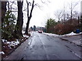
Prestwich, St Mary's Park
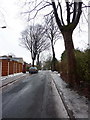
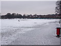
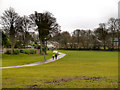
St Mary's Park, near the centre of Prestwich, is divided into two parts, either side of Bury New Road. The formal side (on the western side of the A56, Bury New Road) is called "The Flower Park" (Image]). This photograph shows part of the playing field and urban park on the opposite side (http://www.bury.gov.uk/index.aspx?articleid=4792 Bury Council).
St Mary's Park was officially opened in 1931, by the Earl of Derby. At that time, the park was known as St Mary's Playing Fields, and the Flower Park known as St Mary's Park. St Mary's Playing Fields was originally glebe land (land given to a clergyman) belonging to St Mary's Church, which was bought by Prestwich Urban Council for £100 in 1927 (http://www.bury.gov.uk/index.aspx?articleid=4292).
Image: © David Dixon
Taken: 27 Dec 2012
0.09 miles
8
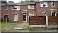
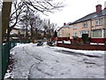
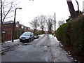
28 Bannerman Avenue, Prestwich
28 Bannerman Avenue in Prestwich, Greater Manchester, is the property in the centre of this photograph; number 30 is on the left, and 26 on the right. These red-brick terraced homes are typical of this part of suburban Prestwich.
Image: © Steven Haslington
Taken: 27 Aug 2012
0.11 miles