IMAGES TAKEN NEAR TO
Southgate, MANCHESTER, M21 8EA
Introduction
This page details the photographs taken nearby to Southgate, M21 8EA by members of the Geograph project.
The Geograph project started in 2005 with the aim of publishing, organising and preserving representative images for every square kilometre of Great Britain, Ireland and the Isle of Man.

There are currently over 7.5m images from over14,400 individuals and you can help contribute to the project by visiting https://www.geograph.org.uk
Image Map
Images are licensed for reuse under creativecommons.org/licenses/by-sa/2.0
Notes
- Clicking on the map will re-center to the selected point.
- The higher the marker number, the further away the image location is from the centre of the postcode.
Image Listing (32 Images Found)
Images are licensed for reuse under creativecommons.org/licenses/by-sa/2.0
Image
Details
Distance
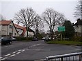
1
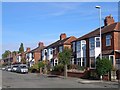
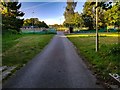
Reeves Road
Reeves Road (eastern side), near junction with Belwood Road
Image: © Janusz Lukasiak
Taken: 12 Oct 2009
0.12 miles
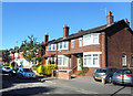
3
Cundiff Road, Chorlton
Looking from the junction with Hardy Lane. The house here were built by Manchester Corporation in the late 1920s / early 1930s.
Image: © Phil Champion
Taken: 18 Dec 2011
0.20 miles
4
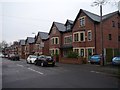
Modern houses on the site of Brook Farm, Brookburn Road
Planning approval for these three storey houses was granted in 2008. The site was formerly an Express Dairies depot, but had been derelict for some time.
Image: © Phil Champion
Taken: 26 Dec 2014
0.20 miles
5
Junction of Brookburn Road with Claude Road
At the entrance to the private Chorltonville estate. http://en.m.wikipedia.org/wiki/Chorltonville
Image: © Phil Champion
Taken: 26 Dec 2014
0.20 miles
6
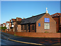
Church of St Barnabas, Hurstville Road, Chorlton
A small mission church within the Church of England parish of St Clement, Chorlton-cum-Hardy, the building appears to be used for occasional worship and more frequent community use.
Image: © Phil Champion
Taken: 18 Dec 2011
0.20 miles
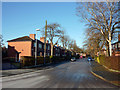
8
Hardy Lane - Mission Failure
Hardy Lane's width gives a clue to the original intent to create a dual carriageway link through to Sale, across the River Mersey and originally in a different county. All the M63 (now M60) junctions were built on that assumption, hence today's impossibility of exiting the M60 northwards from the west and the pain of getting across the Mersey from Sale Moor.
Image: © Peter Whatley
Taken: 1 Apr 2009
0.21 miles
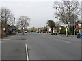
10
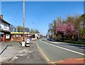
Barlow Moor Road
The A5145 into Chorlton.
Image: © Gerald England
Taken: 8 Apr 2017
0.21 miles