1
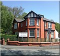
The Duchess of York Hospital for Babies, Burnage.
This hospital was popularly known as Burnage Babies. It is now, sadly, closed and the building is occupied by a nursing home for the elderly. It had a high reputation and took resident medical students as part of their paediatric teaching.
Image: © Peter Ward
Taken: Unknown
0.06 miles
2
Slade Lane
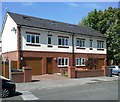
Properties at the corner of Slade Lane and Milwain Street.
Image: © Peter McDermott
Taken: 17 Apr 2017
0.07 miles
3
Dental Surgery, Slade Lane
Image: © Alex McGregor
Taken: 21 May 2012
0.10 miles
4
Slade Lane Bridge
A road bridge over the "Fallowfield Loop", an off-road cycleway and footpath in Manchester. The Loop is part of National Route 6 of the National Cycle Network and was previously part of the old ‘Manchester Central Station Railway’, built in the 1890s and closed in 1988.
Image: © Graham Hogg
Taken: 9 May 2012
0.12 miles
5
2 new houses, Lindsay Road
Image: © Alex McGregor
Taken: 21 May 2012
0.17 miles
6
The Duchess of York Hospital for Babies
Patients' cots on the verandah
Image: © Peter Ward
Taken: Unknown
0.22 miles
7
Burnage on a wet afternoon.
Looking west along Grangethorpe Drive, Burnage, Manchester Typical street for this square. SJ86749327
Image: © Keith Williamson
Taken: 12 Oct 2005
0.23 miles
8
Preston Road, Levenshulme
Typical street in this somewhat down-at-heel area.
Image: © Peter Whatley
Taken: 21 Jan 2009
0.24 miles
9
Burnage United Reformed Church
A 1990s replacement for a Victorian building (note the original gateposts).
Image: © John H Darch
Taken: 8 Sep 2010
0.24 miles
10
Errwood Road Bridge
A road bridge over the "Fallowfield Loop", an off-road cycleway and footpath in Manchester. The Loop is part of National Route 6 of the National Cycle Network and was previously part of the old ‘Manchester Central Station Railway’, built in the 1890s and closed in 1988
Image: © Graham Hogg
Taken: 9 May 2012
0.24 miles


