IMAGES TAKEN NEAR TO
Holmside Gardens, MANCHESTER, M19 1WR
Introduction
This page details the photographs taken nearby to Holmside Gardens, M19 1WR by members of the Geograph project.
The Geograph project started in 2005 with the aim of publishing, organising and preserving representative images for every square kilometre of Great Britain, Ireland and the Isle of Man.

There are currently over 7.5m images from over14,400 individuals and you can help contribute to the project by visiting https://www.geograph.org.uk
Image Map
Images are licensed for reuse under creativecommons.org/licenses/by-sa/2.0
Notes
- Clicking on the map will re-center to the selected point.
- The higher the marker number, the further away the image location is from the centre of the postcode.
Image Listing (52 Images Found)
Images are licensed for reuse under creativecommons.org/licenses/by-sa/2.0
Image
Details
Distance
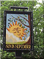
1
The Sun in September
A Sam Smith pub in Manchester,
Image: © Ian S
Taken: 30 Jul 2010
0.05 miles
2
The Sun in September
A Sam Smith's public house.
Image: © Ian S
Taken: 16 Jun 2013
0.05 miles
3
The Sun in September
A Sam Smith's public house.
Image: © Ian S
Taken: 16 Jun 2013
0.05 miles
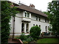
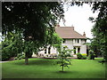
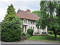
4

Woodcroft Avenue, Manchester
A quiet cul-de-sac of attractive housing that runs south from Barcicroft Road near its junction with Kingsway, a busy dual-carriageway.
Image: © Slbs
Taken: Unknown
0.06 miles
5
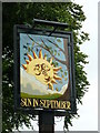
The Sun in September
A Sam Smith pub in Manchester.
Image: © Ian S
Taken: 30 Jul 2010
0.06 miles
6
The Sun in September
A Sam Smith's public house.
Image: © Ian S
Taken: 16 Jun 2013
0.07 miles
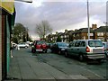
8
Kingsway at Burnage
The A34 into Manchester.
Image: © Gerald England
Taken: 24 Jun 2010
0.11 miles
9
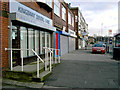
Shops on Lane End Road
Looking east towards the Tesco supermarket.
Image: © Slbs
Taken: Unknown
0.11 miles
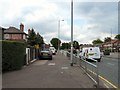
10
Junction of Burnage Lane and Lane End Road
Looking east towards the Tesco supermarket. The Lane that ends here is Fog Lane; Burnage Lane crosses this junction and continues north to Burnage and south to Didsbury Road.
Image: © Slbs
Taken: Unknown
0.11 miles