1
The Church of St Augustine of Canterbury
The first St. Augustine’s Church was built in 1820 on Granby Row, near the present day Manchester Piccadilly Train Station. This first Church was sold and demolished in 1905 to make way for the Manchester Technical College which in turn became UMIST (University of Manchester Institute of Science and Technology) which merged with the Victoria University of Manchester to establish the University of Manchester in 2004.
A second Church was built in 1908 on York Street where the Mancunian Way and the National Computer Centre now cross York Street. This Church, however, was destroyed during the Manchester Blitz of Christmas 1940. After the destruction of the second St. Augustine’s, the Holy Family Church on the present Grosvenor Square site became the parish church. The Holy Family Church,which had previously been a chapel for a Welsh Methodist congregation and later served as the place of worship for the newly founded St. Bede’s College, was demolished in 1966 and the present Church of St Augustine of Canterbury was built on the same site using money from the government's War Damage Commission.
http://manchesterhistory.net/manchester/tours/tour8/area8Apage11.html Manchester History Net
Image: © David Dixon
Taken: 3 Nov 2013
0.03 miles
2
Manchester, Student Living
Manchester Metropolitan University, All Saints Student Living, off Higher Cambridge Street.
Image: © Mike Faherty
Taken: 7 Feb 2019
0.03 miles
3
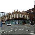
Righton Building
The Grade II listed https://historicengland.org.uk/listing/the-list/list-entry/1197781 glazed brick and terracotta building was built in 1905 as a draper's shop. Pevsner remarked that it has "probably the best-preserved Edwardian shop interior in the city".
It is now occupied by Manchester Metropolitan University's Manchester Institute for Research and Innovation in Art and Design.
Image
Image: © Gerald England
Taken: 11 Nov 2017
0.04 miles
4
Righton Building: Architectural detail
Detail on the Righton Building
Image
Image: © Gerald England
Taken: 11 Nov 2017
0.04 miles
5
Ormond Building, Lower Ormond Street, Manchester
Red brick and stone with a domed corner turret. By Mangnall & Littlewood, 1881. Grade II listed.
Built as offices of the Poor Law Guardians and a Registry Office, like everything else in this area it has been subsumed into Manchester Metropolitan University (the polytechnic when it took over in 1970).
Image: © Stephen Richards
Taken: 15 May 2012
0.04 miles
6
The Church Inn
The Church Inn public house.
Image: © Peter McDermott
Taken: 22 Nov 2015
0.04 miles
7
St Augustine's Catholic Church
The first St. Augustine’s Church was built in 1820 on Granby Row, near the present day Manchester Piccadilly Train Station. This first Church was sold and demolished in 1905 to make way for the Manchester Technical College which in turn became UMIST (University of Manchester Institute of Science and Technology) which merged with the Victoria University of Manchester to establish the University of Manchester in 2004.
A second Church was built in 1908 on York Street where the Mancunian Way and the National Computer Centre now cross York Street. This Church, however, was destroyed during the Manchester Blitz of Christmas 1940. After the destruction of the second St. Augustine’s, the Holy Family Church on the present Grosvenor Square site became the parish church. The Holy Family Church,which had previously been a chapel for a Welsh Methodist congregation and later served as the place of worship for the newly founded St. Bede’s College, was demolished in 1966 and the present Church of St Augustine of Canterbury was built on the same site using money from the government's War Damage Commission.
http://manchesterhistory.net/manchester/tours/tour9/area9page11.html Manchester History Net
Image: © David Dixon
Taken: 3 Nov 2013
0.05 miles
8
Righton Building, Lower Ormond Street, Manchester
Glazed brick and terracotta, built 1905 as a draper's shop. Pevsner remarks that it has "probably the best-preserved Edwardian shop interior in the city". Grade II listed.
Now occupied by Manchester Metropolitan University's Manchester Institute for Research and Innovation in Art and Design.
Image: © Stephen Richards
Taken: 15 May 2012
0.05 miles
9
The Righton Building
Part of the Manchester Metropolitan University campus http://www.mmu.ac.uk/students/building/?building=righton_building .
Image: © Thomas Nugent
Taken: 10 Nov 2014
0.05 miles
10
Righton Building
The Grade II listed https://historicengland.org.uk/listing/the-list/list-entry/1197781?section=official-list-entry building was formerly known as Cavendish House. Originally a draper's shop and showrooms, dating from 1905, it became an annex to the School of Art. It now belongs to the Manchester Metropolitan University.
Image: © Gerald England
Taken: 11 Oct 2022
0.05 miles


