1
Crowne Plaza and Staybridge Suites at MBS
The Crowne Plaza ® Manchester – Oxford Road and Staybridge Suites® Manchester – Oxford Road properties are being built as part of The University of Manchester‘s £1 billion campus development. The two hotels are part of the Alliance Manchester Business School Campus Masterplan https://www.mbs.ac.uk/about/campus-masterplan/ and are due to open in Summer 2018.
Image: © David Dixon
Taken: 7 Aug 2018
0.05 miles
2
Architecture and Planning Building, Bridgeford Street, Manchester
A large low block of grey concrete, ribbed in the oversailing top section. By the "building's then inhabitants, Professors N.L. Hanson and R.H. Kantorowich, with M.C. Schonegevel and G. Skacel, 1970". Pevsner calls it uninspiring, but for my sins I'm a sucker for concrete.
As usual one is being watched.
Image: © Stephen Richards
Taken: 25 Jul 2011
0.05 miles
3
Detail of 176 Oxford Road, Manchester
An example of the fine doorcases in this short terrace (
Image]). Panelled door, slender Doric columns and a gorgeous fanlight.
Image: © Stephen Richards
Taken: 15 May 2012
0.06 miles
4
Manchester Business School and Precinct Centre, Booth Street West, Manchester
Massive development which stretches across Oxford Road into Booth Street East. By Wilson & Womersley, 1970-72, for the University of Manchester. It was designed with elevated walkways over the main roads - that over Booth Street West which connected to the Royal Northern College of Music (just left of shot) has gone, but was there when I was a student in 1985-88, leaving that over Oxford Road as the only relic of that particular scheme (
Image]).
The Business School, part of the University, occupies the near part of the building seen here, while the next two sections with the semi-circular glazed staircase is now occupied by some sort of university innovation centre (the Harold Hankins Building). In its previous incarnation as a hall of residence, Cornbrook House, I called it home for two of my student years. We didn't need centres to go to innovate in my day, we had pubs.
I have to confess it looks unnaturally orange in this photo. I haven't doctored it so I will blame the low summer sun.
Image: © Stephen Richards
Taken: 23 Jul 2011
0.07 miles
5
University of Manchester, Waterloo Place
176 - 188 Oxford Road, known as Waterloo Place, is a terrace of 7 three-bay, two storey houses built in the 1830s. They are now the property of the University of Manchester.
Image: © David Dixon
Taken: 23 Apr 2014
0.07 miles
6
176-188 Oxford Road, Manchester
A nice late-Georgian terrace, Waterloo Place, whose doorcases have Doric columns and fanlights (
Image]). Built c1830. The attic additions are early C20th. Grade II listed.
All are now in use as offices by the University of Manchester.
Image: © Stephen Richards
Taken: 25 Jul 2011
0.07 miles
7
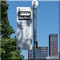
Bus stop on Oxford Road
Bus stop C located on Oxford Road at the University Shopping Centre is for services towards the City Center [sic].
Image: © Gerald England
Taken: 2 Jun 2023
0.07 miles
8
Bus stop C on Oxford Road
Bus stop C located on Oxford Road
Image at the University Shopping Centre is for services towards the City Center [sic].
Image: © Gerald England
Taken: 2 Jun 2023
0.07 miles
9
Waterloo Place
This terrace of 19th century houses is home to Manchester University's Humanities Departmental admin offices.
Image: © Glyn Baker
Taken: 1 Sep 2018
0.07 miles
10
Precinct Centre, Oxford Road, Manchester
The shopping centre built as part of Wilson & Womersley's large development for the University of Manchester, 1970-72. Behind the glass tent-like roofs is the back of the block pictured here
Image
During my time as a student here in 1985-88, it was thriving, but it since appears to have hit hard times. Most of the shops were empty. Delta Travel was there in my time, but only their signage remains. Natwest was still there, but the adjacent food outlet, very handy for chips between Maths lecturers, now cruelly tempts students when it offers nothing more than faded pictures.
Image: © Stephen Richards
Taken: 25 Jul 2011
0.07 miles


