Architecture and Planning Building, Bridgeford Street, Manchester
Introduction
The photograph on this page of Architecture and Planning Building, Bridgeford Street, Manchester by Stephen Richards as part of the Geograph project.
The Geograph project started in 2005 with the aim of publishing, organising and preserving representative images for every square kilometre of Great Britain, Ireland and the Isle of Man.

There are currently over 7.5m images from over 14,400 individuals and you can help contribute to the project by visiting https://www.geograph.org.uk
Architecture and Planning Building, Bridgeford Street, Manchester
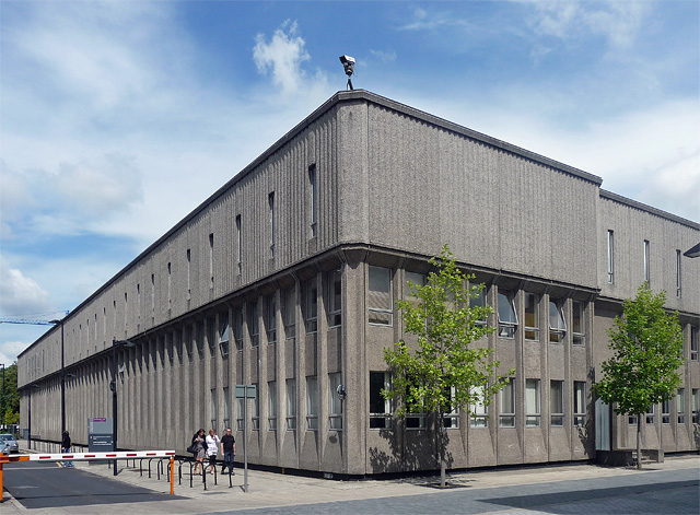
Image: © Stephen Richards Taken: 25 Jul 2011
A large low block of grey concrete, ribbed in the oversailing top section. By the "building's then inhabitants, Professors N.L. Hanson and R.H. Kantorowich, with M.C. Schonegevel and G. Skacel, 1970". Pevsner calls it uninspiring, but for my sins I'm a sucker for concrete. As usual one is being watched.
Images are licensed for reuse under creativecommons.org/licenses/by-sa/2.0
Image Location
Latitude
53.466086
Longitude
-2.236603