IMAGES TAKEN NEAR TO
Ellesmere Street, MANCHESTER, M15 4RU

Introduction

This page details the photographs taken nearby to Ellesmere Street, M15 4RU by members of the Geograph project.

The Geograph project started in 2005 with the aim of publishing, organising and preserving representative images for every square kilometre of Great Britain, Ireland and the Isle of Man.

There are currently over 7.5m images from over14,400 individuals and you can help contribute to the project by visiting https://www.geograph.org.uk

Image Map


Images are licensed for reuse under creativecommons.org/licenses/by-sa/2.0
Notes
  • Clicking on the map will re-center to the selected point.
  • The higher the marker number, the further away the image location is from the centre of the postcode.

Image Listing (237 Images Found)

Images are licensed for reuse under creativecommons.org/licenses/by-sa/2.0
  • ...
Image
Details
Distance
1
St George's
Development in St George's.
Image: © Peter McDermott Taken: 22 Apr 2017
0.02 miles
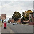
2
Chester Road (A56)
Image: © David Dixon Taken: 2 Nov 2021
0.03 miles
3
Chester Road
The A56 passing the end of Manson Avenue.
Image: © Gerald England Taken: 17 Oct 2015
0.04 miles
4
Albert Mill, Ellesmere Street, Manchester
Former cotton mill dated 1869 on the return. The listing remarks that "timber-floored construction (at this date) suggests use for one of the specialised minor branches of the textile industry." Grade II listed. Now offices and flats above.
Image: © Stephen Richards Taken: 29 May 2017
0.04 miles
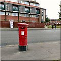
5
Edwardian Postbox on Chester Road
The A56 into Manchester. Near the corner of Hulme Hall Road is an Edward VII post box Image
Image: © Gerald England Taken: 17 Oct 2015
0.05 miles
6
Edward VII Postbox (M16 146D)
Edwardian postbox on Chester Road Image
Image: © Gerald England Taken: 17 Oct 2015
0.05 miles
7
Excelsior Mill
The new 'Excelsior Mill' residential development.
Image: © Peter McDermott Taken: 2 Sep 2018
0.05 miles
8
Private canal basin, west of Hulme Hall Road bridge [no 99]
A boater's view. In 1915 this served a timber yard and saw mill.
Image: © Christine Johnstone Taken: 22 May 2021
0.05 miles
9
Shops on Chester Road
The A56 passing through the St George's area.
Image: © Gerald England Taken: 17 Oct 2015
0.06 miles
10
Excelsior Mill
Now demolished Excelsior Mill, seen in 2013.
Image: © Phill Taken: 13 Mar 2013
0.06 miles
  • ...