IMAGES TAKEN NEAR TO
Fairfield Street, MANCHESTER, M1 2WG
Introduction
This page details the photographs taken nearby to Fairfield Street, M1 2WG by members of the Geograph project.
The Geograph project started in 2005 with the aim of publishing, organising and preserving representative images for every square kilometre of Great Britain, Ireland and the Isle of Man.

There are currently over 7.5m images from over14,400 individuals and you can help contribute to the project by visiting https://www.geograph.org.uk
Image Map
Images are licensed for reuse under creativecommons.org/licenses/by-sa/2.0
Notes
- Clicking on the map will re-center to the selected point.
- The higher the marker number, the further away the image location is from the centre of the postcode.
Image Listing (269 Images Found)
Images are licensed for reuse under creativecommons.org/licenses/by-sa/2.0
Image
Details
Distance
2
True Jesus Church
Emitex House on St Andrews Street is home to the True Jesus Church. The True Jesus Church was established in 1917 in Beijing, China. https://tjc.org/history/
Image: © Gerald England
Taken: 21 Feb 2019
0.03 miles
3
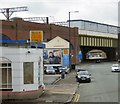
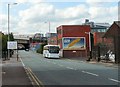
Fairfield Street
The B6469 (formerly A635) passing under the railway viaduct carrying trains into Piccadilly.
Image: © Gerald England
Taken: 13 Jun 2015
0.05 miles
4
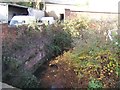
River Medlock downstream of Fairfield Street
Image: © John M
Taken: 22 Nov 2011
0.05 miles
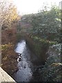
5

River Medlock From Fairfield Street
Looking downstream just a stone's throw from Piccadilly Station
Image: © Glyn Baker
Taken: 11 Sep 2021
0.05 miles
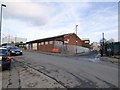
6
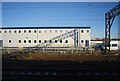
Network Rail building by the West Coast Main Line
Image: © N Chadwick
Taken: 18 Dec 2011
0.05 miles
7
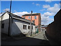
Coronation Square
Leading to Fairfield Street, viewed from North Western Street.
Image: © John Topping
Taken: 13 Mar 2013
0.05 miles
8
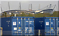
Shipping containers by the railway line
Viewed from a train approaching Piccadilly station from the south. Etihad Stadium can also be seen.
Image: © Thomas Nugent
Taken: 19 Oct 2018
0.06 miles
9
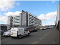
St. Andrew's Street
Network Rail/Square One Office building in view.
Image: © John Topping
Taken: 13 Mar 2013
0.07 miles
10
Fairfield Street
Before the A635 from Ashton under Lyne was diverted along the Mancunian Way, this was the main road into Manchester from the East. Now the B6469, it crosses London Road by Piccadilly Station and then becomes Whitworth Street.
Image: © Gerald England
Taken: 22 Aug 2009
0.07 miles