IMAGES TAKEN NEAR TO
London Road, MANCHESTER, M1 2PW

Introduction

This page details the photographs taken nearby to London Road, M1 2PW by members of the Geograph project.

The Geograph project started in 2005 with the aim of publishing, organising and preserving representative images for every square kilometre of Great Britain, Ireland and the Isle of Man.

There are currently over 7.5m images from over14,400 individuals and you can help contribute to the project by visiting https://www.geograph.org.uk

Image Map


Images are licensed for reuse under creativecommons.org/licenses/by-sa/2.0
Notes
  • Clicking on the map will re-center to the selected point.
  • The higher the marker number, the further away the image location is from the centre of the postcode.

Image Listing (1504 Images Found)

Images are licensed for reuse under creativecommons.org/licenses/by-sa/2.0
  • ...
Image
Details
Distance
1
Fire Station Entrance, London Road
Image: © Stanley Walker Taken: Unknown
0.01 miles
2
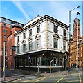
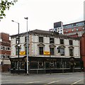
Bulls Head
The Bulls Head sits on the corner of London Road and Fairfield Street. Today it is a Marston's pub but during its life it has also been affiliated with both Wilson's and Burtonwood. Image The pub is believed to date from 1786 but surprisingly it doesn't appear on an 1849 map of the area, but is shown on an 1851 map. Links to old photographs can be found on the Pubs of Manchester site http://pubs-of-manchester.blogspot.co.uk/2010/01/2-bulls-head.html
Image: © Gerald England Taken: 8 Oct 2012
0.01 miles
3
Sign of the Bulls Head
Sign for the Bulls Head Image
Image: © Gerald England Taken: 8 Oct 2012
0.01 miles
4
Bulls Head, London Road, Manchester
Marston's pub with en-suite accommodation at 84 London Road, near Manchester Piccadilly railway station.
Image: © Jaggery Taken: 10 Sep 2016
0.01 miles
5
London Road
Looking South from the footbridge approaching Piccadilly Station. On the right is the Hotel International, Monroe's Hotel and London Road Fire Station.
Image: © Gerald England Taken: 25 Jun 2009
0.01 miles
6
Former fire station, London Road
Image: © Christopher Hilton Taken: 24 Oct 2009
0.01 miles
7
Former fire station, London Road
Image: © Christopher Hilton Taken: 24 Oct 2009
0.01 miles
8
Former fire station, London Road
Image: © Christopher Hilton Taken: 24 Oct 2009
0.01 miles
9
London Road
The A6 London Road, viewed from a passing train.
Image: © Thomas Nugent Taken: 6 Jul 2020
0.02 miles
10
Bulls Head
The Bulls Head sits on the corner of London Road and Fairfield Street. Today it is a Marston's pub but during its life it has also been affiliated with both Wilson's and Burtonwood. Image It has been suggested that the pub dates from 1786 but surprisingly it doesn't appear an 1849 map of the area, but is shown on an 1851 map. Links to old photographs can be found on the Pubs of Manchester site http://pubs-of-manchester.blogspot.co.uk/2010/01/2-bulls-head.html
Image: © Gerald England Taken: 1 Jun 2013
0.02 miles
  • ...