IMAGES TAKEN NEAR TO
Windsor Road, LEIGHTON BUZZARD, LU7 9FA
Introduction
This page details the photographs taken nearby to Windsor Road, LU7 9FA by members of the Geograph project.
The Geograph project started in 2005 with the aim of publishing, organising and preserving representative images for every square kilometre of Great Britain, Ireland and the Isle of Man.

There are currently over 7.5m images from over14,400 individuals and you can help contribute to the project by visiting https://www.geograph.org.uk
Image Map
Images are licensed for reuse under creativecommons.org/licenses/by-sa/2.0
Notes
- Clicking on the map will re-center to the selected point.
- The higher the marker number, the further away the image location is from the centre of the postcode.
Image Listing (8 Images Found)
Images are licensed for reuse under creativecommons.org/licenses/by-sa/2.0
Image
Details
Distance
1
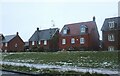
New houses on Westfield Road, Pitstone
Image: © David Howard
Taken: 18 Dec 2022
0.10 miles
2
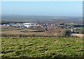
Pitstone - industrial units and new estate
To the south and west of the original village of Pitstone are these huge new industrial units housing high tech modern factories and data warehouses. To the east of these nearer the original Church End of the village is a large new estate of modern houses. The photograph is taken from the Ridgeway LDP on the northern flank of Pitstone Hill.
Image: © Rob Farrow
Taken: 29 Dec 2013
0.13 miles
3
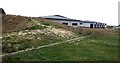
New industrial units, Pitstone.
There are a number of new business units of varying types, mostly of medium to hi-tech industries in this business park. The entire site is built on land which used to be the Pitstone Cement Works whose now-demolished chimneys were a notable local feature for decades.
A bit more information about the former works can be found here Image]
Image: © Rob Farrow
Taken: 9 Jan 2007
0.18 miles
4

Kiln 5, Pitstone cement plant
This shows the Dry Process kiln system across an expanse of worked out marl pit. The picture was taken in 1977, before the second preheater stage was installed. The kiln started up in 1970 and shut down in 1991, after which the entire site was cleared. The centre section of the kiln was used to construct Padeswood kiln 4 (see Image). The stack was at SP9337214878. Rightwards from the stack, are the three parallel electrostatic precipitators, with dog-leg inlet ducts. Next come the three crusher/driers used to dry and roughly grind the very wet chalk/marl raw material, then the short preheater tower. Behind the kiln are silos for dried raw material, the rawmill and a set of rawmix blending silos. At the nearer (hot) end of the kiln, under an open sided canopy, part of the planetary cooler can be seen. In front of that, the triangular sectioned building is the 40,000 tonne clinker store. For more details, see http://www.cementkilns.co.uk/cement_kiln_pitstone.html.
Image: © Dylan Moore
Taken: Unknown
0.20 miles

6
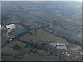
Pitstone chalk pits from the air
On approach to Luton Airport from the south.
Image: © Thomas Nugent
Taken: 29 Mar 2013
0.22 miles