
IMAGES TAKEN NEAR TO
Grange Close, LEIGHTON BUZZARD, LU7 2PP
Introduction
This page details the photographs taken nearby to Grange Close, LU7 2PP by members of the Geograph project.
The Geograph project started in 2005 with the aim of publishing, organising and preserving representative images for every square kilometre of Great Britain, Ireland and the Isle of Man.

There are currently over 7.5m images from over14,400 individuals and you can help contribute to the project by visiting https://www.geograph.org.uk
Image Map
Images are licensed for reuse under creativecommons.org/licenses/by-sa/2.0
Notes
- Clicking on the map will re-center to the selected point.
- The higher the marker number, the further away the image location is from the centre of the postcode.
Image Listing (167 Images Found)
Images are licensed for reuse under creativecommons.org/licenses/by-sa/2.0
Image
Details
Distance
1
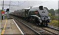
A4 60009 Union of South Africa passing Leighton Buzzard
A4 60009 Union of South Africa passes through Leighton Buzzard station on 'The Cheshireman' railtour from London Euston.
Image: © Bob Walters
Taken: 20 Sep 2014
0.03 miles
2
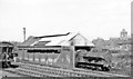
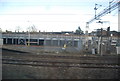
Leighton Buzzard Locomotive Shed, 1960
View east, probably from a passing Down train on the WCML, just before the station - which is really in Linslade. Outside the Shed is 0-8-0 No. 48953, one of innumerable ex-LNW 'Super-D' Class 7F, introduced by Webb in 1896 as 3-cylinder compounds, later converted by Bowen-Cooke as 2-cylinder simples, and many being fitted with superheaters. This one was so fitted in 12/39 and lasted on BR until 10/61. The little Shed closed soon after the ex-LNW branch to Dunstable North closed on 28/4/65.
Image: © Ben Brooksbank
Taken: 10 Apr 1960
0.04 miles
3
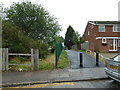
Path from Southcourt Avenue to Grange Close
Image: © Basher Eyre
Taken: 8 Sep 2011
0.08 miles
4
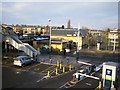
Linslade: Leighton Buzzard railway station
Anyone arriving at Leighton Buzzard railway station expecting to be in the town centre would be disappointed because the station is in Linslade on the opposite side of the valley of the River Ouzel and about 1 kilometre away from Leighton Buzzard to the west. This view was taken looking northwards from the footbridge to the south of the station.
Image: © Nigel Cox
Taken: 28 Dec 2005
0.08 miles
5
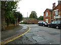
Looking from Waterloo Road towards Pine Crest Mews
Image: © Basher Eyre
Taken: 8 Sep 2011
0.08 miles
7
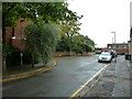
Approaching The Gables from Waterloo Road
Image: © Basher Eyre
Taken: 8 Sep 2011
0.10 miles
9
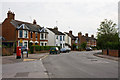
Southcourt Avenue
Taken from Southcourt Road, Southcourt Avenue forms both the continuation of the main road on the right and the side road on the left.
Image: © Martin Addison
Taken: 5 Jun 2010
0.10 miles
10
Looking from Victoria Road into The Gables
Image: © Basher Eyre
Taken: 8 Sep 2011
0.10 miles