IMAGES TAKEN NEAR TO
Wyngates, LEIGHTON BUZZARD, LU7 2LD
Introduction
This page details the photographs taken nearby to Wyngates, LU7 2LD by members of the Geograph project.
The Geograph project started in 2005 with the aim of publishing, organising and preserving representative images for every square kilometre of Great Britain, Ireland and the Isle of Man.

There are currently over 7.5m images from over14,400 individuals and you can help contribute to the project by visiting https://www.geograph.org.uk
Image Map
Images are licensed for reuse under creativecommons.org/licenses/by-sa/2.0
Notes
- Clicking on the map will re-center to the selected point.
- The higher the marker number, the further away the image location is from the centre of the postcode.
Image Listing (63 Images Found)
Images are licensed for reuse under creativecommons.org/licenses/by-sa/2.0
Image
Details
Distance
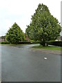
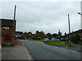
1
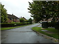
Looking from Cedars Way into Finch Crescent
Image: © Basher Eyre
Taken: 8 Sep 2011
0.05 miles
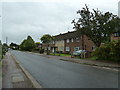
4
Junction of Cedars Way and Finch Crescent
Image: © Basher Eyre
Taken: 8 Sep 2011
0.06 miles
5
Approaching the junction of Cedar Way and Finch Crescent
Image: © Basher Eyre
Taken: 8 Sep 2011
0.07 miles
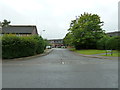
7
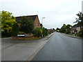
Junction of Cedars Way and Ledburn Grove
Image: © Basher Eyre
Taken: 8 Sep 2011
0.08 miles
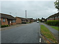
8
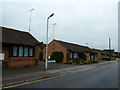
Bungalows in Ledburn Grove
Taken from Cedars Way.
Image: © Basher Eyre
Taken: 8 Sep 2011
0.08 miles
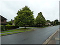
10
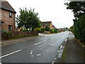
Looking south-southeast along Cedars Way
Image: © Basher Eyre
Taken: 8 Sep 2011
0.08 miles