IMAGES TAKEN NEAR TO
Tythe Close, LEIGHTON BUZZARD, LU7 0HD
Introduction
This page details the photographs taken nearby to Tythe Close, LU7 0HD by members of the Geograph project.
The Geograph project started in 2005 with the aim of publishing, organising and preserving representative images for every square kilometre of Great Britain, Ireland and the Isle of Man.

There are currently over 7.5m images from over14,400 individuals and you can help contribute to the project by visiting https://www.geograph.org.uk
Image Map
Images are licensed for reuse under creativecommons.org/licenses/by-sa/2.0
Notes
- Clicking on the map will re-center to the selected point.
- The higher the marker number, the further away the image location is from the centre of the postcode.
Image Listing (128 Images Found)
Images are licensed for reuse under creativecommons.org/licenses/by-sa/2.0
Image
Details
Distance
1
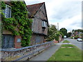
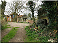
Dove House on High Street South, Stewkley
Image: © Mat Fascione
Taken: 16 Aug 2015
0.04 miles
2
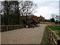
Out of its element
An International Harvester's 584 tractor sits on a neatly prepared gravel road - somehow I think it'd be happier playing in the mud! In the background is a new housing development on the outskirts of Stewkley.
Image: © Martin Addison
Taken: 9 Apr 2007
0.06 miles

4
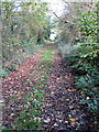
Coming in to Stewkley on the Circular Walk
Image: © Philip Jeffrey
Taken: 30 Oct 2012
0.08 miles
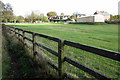
6
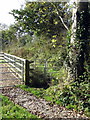
Returning to Stewkley
On the Stewkley Circular Walk, at the top of a steady climb, the village comes into view. On the right there is an earthenware u-bend and, behind the ivy, stored slates. Further down the hill there were many other salvaged items of building material beside the track.
Image: © Martin Addison
Taken: 9 Apr 2007
0.08 miles
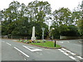
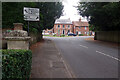
7
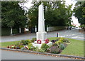
War memorial in Stewkley
At the junction of the High Street North and the High Street South.
Image: © Mat Fascione
Taken: 16 Aug 2015
0.09 miles
10
High Street North, Stewkley
Stewkley claims to have one of the longest village high streets in England, stretching some 1.7 miles and divided into High Street North and High Street South. The population, at the 2011 census was 1,840. This view shows High Street North by the churchyard gate; the junction ahead is where it meets High Street South (to the right) and Soulbury Road. It is part of the B4032 Winslow to Leighton Buzzard road.
Image: © Stephen McKay
Taken: 1 Sep 2021
0.10 miles