IMAGES TAKEN NEAR TO
Grange Court, Grange Gardens, LEIGHTON BUZZARD, LU7 0BW
Introduction
This page details the photographs taken nearby to Grange Court, Grange Gardens, LU7 0BW by members of the Geograph project.
The Geograph project started in 2005 with the aim of publishing, organising and preserving representative images for every square kilometre of Great Britain, Ireland and the Isle of Man.

There are currently over 7.5m images from over14,400 individuals and you can help contribute to the project by visiting https://www.geograph.org.uk
Image Map
Images are licensed for reuse under creativecommons.org/licenses/by-sa/2.0
Notes
- Clicking on the map will re-center to the selected point.
- The higher the marker number, the further away the image location is from the centre of the postcode.
Image Listing (11 Images Found)
Images are licensed for reuse under creativecommons.org/licenses/by-sa/2.0
Image
Details
Distance
4
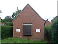
Telephone Exchange, Heath and Reach
Situated in Birds Hill, this TE dates from the GPO era, although it has been extended in recent decades. The BT warning notices and the louvre, presumably to keep the TE air-cooled, can be clearly seen in this photo. This TE has (01525) 237xxx numbers, the (01525) referring to the Leighton Buzzard group of TEs, and its postcode is LU7 0AQ.
Image: © David Hillas
Taken: 10 Sep 2011
0.12 miles
5
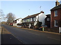
The Cock Hotel, Heath and Reach
Not far from the other Stonehenge. Amongst the beers, London Pride the regular.
Image: © al partington
Taken: 21 Dec 2007
0.12 miles
6
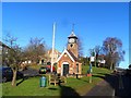
Pump House, Heath and Reach
Constructed in 1973. See http://www.britishlistedbuildings.co.uk/en-35961-village-pumphouse-and-clock-tower-heath-a for listed building entry and http://www.bedfordshire.gov.uk/CommunityAndLiving/ArchivesAndRecordOffice/CommunityArchives/HeathandReach/HeathGreenClockTowerAndPumpHeathAndReach.aspx for further information and old pictures.
Image: © Bikeboy
Taken: 16 Feb 2014
0.14 miles
8
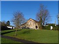
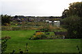
Former Wesleyan Chapel
Built 1977. Now converted into offices.
Image: © Bikeboy
Taken: 16 Feb 2014
0.17 miles
9
Houses on Linslade Road, Heath and Reach
During a sudden downpour
Image: © David Howard
Taken: 27 Jun 2020
0.18 miles