
IMAGES TAKEN NEAR TO
Pebblemoor, DUNSTABLE, LU6 2HZ
Introduction
This page details the photographs taken nearby to Pebblemoor, LU6 2HZ by members of the Geograph project.
The Geograph project started in 2005 with the aim of publishing, organising and preserving representative images for every square kilometre of Great Britain, Ireland and the Isle of Man.

There are currently over 7.5m images from over14,400 individuals and you can help contribute to the project by visiting https://www.geograph.org.uk
Image Map
Images are licensed for reuse under creativecommons.org/licenses/by-sa/2.0
Notes
- Clicking on the map will re-center to the selected point.
- The higher the marker number, the further away the image location is from the centre of the postcode.
Image Listing (4 Images Found)
Images are licensed for reuse under creativecommons.org/licenses/by-sa/2.0
Image
Details
Distance
1

Dormer bungalows on Townside
Dormer bungalows are not really bungalows, as they have two storeys, but they are a nice amalgam. These date from the 1960s I think. Extremely well kept. As you would expect.
Image: © Jeremy Bolwell
Taken: 16 Jan 2022
0.13 miles
2

Lane approaching the village
The rough grazing here looks like it will be developed for housing.
Image: © Jeremy Bolwell
Taken: 16 Jan 2022
0.15 miles
3
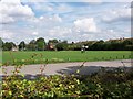
Part of Edlesborough village green
Used for football, tennis and cricket, as well as a general playing area
Image: © John Webster
Taken: 22 Aug 2004
0.17 miles
4
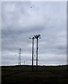
Power lines
On the left can be seen the National Grid High Tension electricity cables which run parallel to the top of the grid square. In the foreground, a less lofty lower tension supply cuts across it. Above them a light aircraft can be seen towing a glider which has taken off from Dunstable Downs. Gliding is a popular pastime in this neck of the woods as the thermals rising over Dunstable Downs provide plenty of lift.
Image: © Rob Farrow
Taken: 22 Feb 2009
0.24 miles