IMAGES TAKEN NEAR TO
Poplar Farm Mobile Home Park, Castle Hill Road, DUNSTABLE, LU6 1QH
Introduction
This page details the photographs taken nearby to Poplar Farm Mobile Home Park, Castle Hill Road, LU6 1QH by members of the Geograph project.
The Geograph project started in 2005 with the aim of publishing, organising and preserving representative images for every square kilometre of Great Britain, Ireland and the Isle of Man.

There are currently over 7.5m images from over14,400 individuals and you can help contribute to the project by visiting https://www.geograph.org.uk
Image Map
Images are licensed for reuse under creativecommons.org/licenses/by-sa/2.0
Notes
- Clicking on the map will re-center to the selected point.
- The higher the marker number, the further away the image location is from the centre of the postcode.
Image Listing (29 Images Found)
Images are licensed for reuse under creativecommons.org/licenses/by-sa/2.0
Image
Details
Distance
1
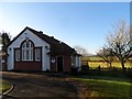
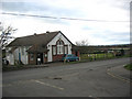
Totternhoe Memorial Hall
Opened in 1928 as a memorial to those killed in the first world war.
Image: © Bikeboy
Taken: 16 Feb 2014
0.03 miles
3
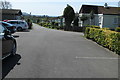
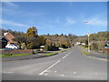
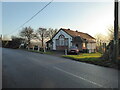
Track or drive in Totternhoe
Access to a property I assume?
Image: © Jeremy Bolwell
Taken: 16 Jan 2022
0.09 miles
5
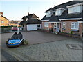
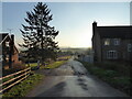
Frontage of a property in Totternhoe
Maybe the owner used to run a dodgems ride at fairs around the country? Or met his wife on this very dodgem? Or is it a totem for his attitude to life's problems: just dodgem. I am tempted to knock the door and find out.
A sentiment on the message we can all agree with.
Image: © Jeremy Bolwell
Taken: 16 Jan 2022
0.09 miles
8
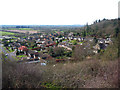
Castle Close, Totternhoe
Castle Close and Brownlow Rise, surrounded by the Totternhoe Knolls and viewed from the footpath along the top of the Knolls.
Image: © Marc Cohen
Taken: 29 Jan 2007
0.13 miles
9
Totternhoe Memorial Hall
A war memorial village hall, now operating as a bar, hostelry or pub I believe.
Image: © Jeremy Bolwell
Taken: 16 Jan 2022
0.13 miles
10
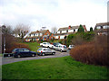
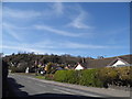
Houses on Castle Hill Road
These houses are built on the lower slopes of the Knolls and offer far reaching views across the surrounding countryside.
Image: © Marc Cohen
Taken: 29 Jan 2007
0.15 miles