
IMAGES TAKEN NEAR TO
Whipperley Ring, LUTON, LU1 5QF
Introduction
This page details the photographs taken nearby to Whipperley Ring, LU1 5QF by members of the Geograph project.
The Geograph project started in 2005 with the aim of publishing, organising and preserving representative images for every square kilometre of Great Britain, Ireland and the Isle of Man.

There are currently over 7.5m images from over14,400 individuals and you can help contribute to the project by visiting https://www.geograph.org.uk
Image Map
Images are licensed for reuse under creativecommons.org/licenses/by-sa/2.0
Notes
- Clicking on the map will re-center to the selected point.
- The higher the marker number, the further away the image location is from the centre of the postcode.
Image Listing (15 Images Found)
Images are licensed for reuse under creativecommons.org/licenses/by-sa/2.0
Image
Details
Distance
1
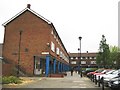
Luton: Market Square, Farley Hill
Farley Hill is a large post-war housing estate built on the fields to the north of the former Farley Farm. Market Square is the main community shopping area.
Image: © Nigel Cox
Taken: 16 May 2008
0.02 miles
2
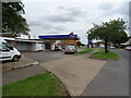
Service station on Whipperley Ring, Farley Hill, Luton
Image: © JThomas
Taken: 3 Aug 2019
0.07 miles
4
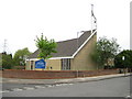
Luton: The church of St John the Baptist, Farley Hill
When the Farley Hill Estate was laid out the designers considered the pastoral needs of the population and two churches were built at either end of the road in the estate called Santingfield. This is the Church of England Parish Church of St John the Baptist, built in 1969 in Santingfield South at its junction with South Drift Way. See Image for the other church. The asymmetrical shape of the design is typical of church architecture of the 1960s. The church's website is here http://www.stjohn-luton.co.uk/ Curiously the Ordnance Survey's 1:10,000 scale maps do not show this as a "Place of Worship". Usually they are very thorough about this.
Image: © Nigel Cox
Taken: 16 May 2008
0.12 miles
6
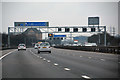
Central Bedfordshire : M1 Motorway
The M1 Motorway seen between Junction 11 and Junction 10 (Pepperstock).
Image: © Lewis Clarke
Taken: 25 Mar 2018
0.17 miles
8

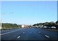
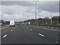
Central Bedfordshire : M1 Motorway
The M1 Motorway seen between Junction 11 and Junction 10 (Pepperstock).
Image: © Lewis Clarke
Taken: 3 Oct 2018
0.18 miles
10
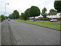
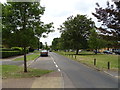
Luton: Santingfield North, Farley Hill
At first glance this appears to be a typical housing estate road with a central grassed island separating two carriageways with traffic running in different directions, but look carefully and it can be seen that these are two separate roads with traffic able to travel in both directions along both roads, quite disconcerting for the stranger to the area! This is evidenced by the two parked cars on either road and the orange British School of Motoring (BSM) car with its learner driver practising a three point turn on the right. With its wide quiet streets this is learner driver territory with a vengeance.
Image: © Nigel Cox
Taken: 16 May 2008
0.20 miles