
IMAGES TAKEN NEAR TO
Mancroft Road, LUTON, LU1 4EJ
Introduction
This page details the photographs taken nearby to Mancroft Road, LU1 4EJ by members of the Geograph project.
The Geograph project started in 2005 with the aim of publishing, organising and preserving representative images for every square kilometre of Great Britain, Ireland and the Isle of Man.

There are currently over 7.5m images from over14,400 individuals and you can help contribute to the project by visiting https://www.geograph.org.uk
Image Map
Images are licensed for reuse under creativecommons.org/licenses/by-sa/2.0
Notes
- Clicking on the map will re-center to the selected point.
- The higher the marker number, the further away the image location is from the centre of the postcode.
Image Listing (16 Images Found)
Images are licensed for reuse under creativecommons.org/licenses/by-sa/2.0
Image
Details
Distance
4
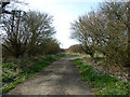
Track to Cradle Spinney
This track is gated to prevent vehicular access. It leads first to Cradle Spinney then bends sharply to the left (west) to meet up with the lane to Bury Farm (see Image]) - alternatively it continues as a footpath to Castlecroft Wood and beyond all the way to Dunstable.
Image: © Rob Farrow
Taken: 29 Mar 2012
0.15 miles
5
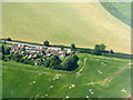
Dunstable Road, Caddington
An outlier of cottages to the west of the village. Not sure what might have caused the blanks in the cereal field - some problem with the seed drill?
Image: © M J Richardson
Taken: 11 Jul 2013
0.17 miles
8
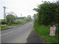
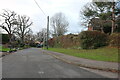
Caddington: Dunstable Road
Viewed looking towards Dunstable from the Mancroft Road junction.
Image: © Nigel Cox
Taken: 13 May 2006
0.19 miles
9
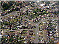
Caddington from the air
Looking along Elm Avenue to its T-junction with Manor Road, with The Crescent going off to the right and The Dell on the left.
Image: © M J Richardson
Taken: 11 Jul 2013
0.19 miles
10
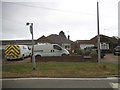
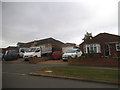
Bungalows on Manor Road, Caddington
The one on the left had a new roof in 2016
Image: © David Howard
Taken: 19 Jul 2017
0.21 miles