
IMAGES TAKEN NEAR TO
Dunstable Place, LUTON, LU1 2QD
Introduction
This page details the photographs taken nearby to Dunstable Place, LU1 2QD by members of the Geograph project.
The Geograph project started in 2005 with the aim of publishing, organising and preserving representative images for every square kilometre of Great Britain, Ireland and the Isle of Man.

There are currently over 7.5m images from over14,400 individuals and you can help contribute to the project by visiting https://www.geograph.org.uk
Image Map
Images are licensed for reuse under creativecommons.org/licenses/by-sa/2.0
Notes
- Clicking on the map will re-center to the selected point.
- The higher the marker number, the further away the image location is from the centre of the postcode.
Image Listing (119 Images Found)
Images are licensed for reuse under creativecommons.org/licenses/by-sa/2.0
Image
Details
Distance
1

Luton Town Hall
The imposing Town Hall in the centre of Luton.
Image: © Richard Thomas
Taken: 2 Jun 2006
0.04 miles
2

Decommissioned stamp vending machines, Luton
Image: © Jim Osley
Taken: 21 Mar 2015
0.04 miles
3
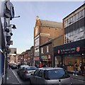
Northwest and downhill on Wellington Street, Luton
In a street of restaurants and fast food outlets, this four-storey building stands out. The datestone on the gable says 1906. While it might have been a hatmaker's (hatmaking was a major industry in Luton) it looks more like a former furniture showroom. It is seen square-on in Burgess von Thunen's Image from 2013. In this photo, note the large Salvation Army charity shop on the right.
Image: © Robin Stott
Taken: 24 Feb 2017
0.04 miles
4
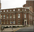
Former post office, Upper George Street
Built c.1923 to the designs of Office of Works architect Roland Ingleby Smith.
Image: © Jim Osley
Taken: 21 Mar 2015
0.05 miles
5
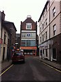
Ultimate ConneXions Ltd
Estate agents in a 1906 building in Wellington Street, taken from Peel Street.
Image: © Burgess Von Thunen
Taken: 2 Oct 2013
0.06 miles
6
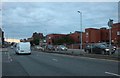
Stuart Street, Luton
The magistrates court is on the right
Image: © David Howard
Taken: 6 Sep 2020
0.07 miles
7

Art Deco in Luton ??relief sculpture above window, former Ritz Cinema, Gordon Street
More of the building is seen in Image
Image: © Robin Stott
Taken: 24 Feb 2017
0.07 miles
8
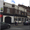
The Duke of Clarence, Upper George Street, Luton
The date above the pub sign is 1931. It looks as though the first floor of a Victorian pub has had a 1930s makeover.
Image: © Robin Stott
Taken: 24 Feb 2017
0.07 miles
9
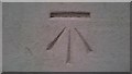
Ordnance Survey Benchmark - Luton Town Hall
Ordnance Survey Benchmark (OSBM) used for levelling height above Ordnance Datum (OD).
Height: 110.8200m OD (Newlyn). Mark verified by the Ordnance Survey in 1958. Description: NBM LUTON TOWN HALL S FACE SE ANG. 0.4m above ground. 3rd Order BM.
Context: Image
Image: © N Scott
Taken: 23 Sep 2017
0.07 miles
10
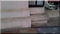
Ordnance Survey Benchmark - Luton Town Hall
Ordnance Survey Benchmark (OSBM) used for levelling height above Ordnance Datum (OD).
Height: 110.8200m OD (Newlyn). Mark verified by the Ordnance Survey in 1958. Description: NBM LUTON TOWN HALL S FACE SE ANG. 0.4m above ground. 3rd Order BM.
Close-up: Image
Image: © N Scott
Taken: 23 Sep 2017
0.07 miles