
IMAGES TAKEN NEAR TO
Avondale Road, LUTON, LU1 1DT
Introduction
This page details the photographs taken nearby to Avondale Road, LU1 1DT by members of the Geograph project.
The Geograph project started in 2005 with the aim of publishing, organising and preserving representative images for every square kilometre of Great Britain, Ireland and the Isle of Man.

There are currently over 7.5m images from over14,400 individuals and you can help contribute to the project by visiting https://www.geograph.org.uk
Image Map
Images are licensed for reuse under creativecommons.org/licenses/by-sa/2.0
Notes
- Clicking on the map will re-center to the selected point.
- The higher the marker number, the further away the image location is from the centre of the postcode.
Image Listing (29 Images Found)
Images are licensed for reuse under creativecommons.org/licenses/by-sa/2.0
Image
Details
Distance
1
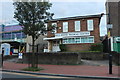
Bell House Medical Centre on Dunstable Road
Image: © David Howard
Taken: 6 Sep 2020
0.05 miles
2
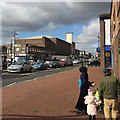
Former cinema at 127 Dunstable Road, Bury Park, Luton
Currently the Calvary Church of God in Christ, before that a bingo hall, but built as an Odeon cinema 1937-8 and listed Grade II as "a rare example of thorough-going International Modernism applied to a cinema." Put another way, it isn't Art Deco. List entry number 1356878. Dunstable Road is busy with traffic to and from the M1 Junction 11. Bury Park is a bustling shopping area for the predominantly Pakistani community.
Image: © Robin Stott
Taken: 24 Feb 2017
0.07 miles
3
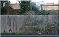
Don't take a fence
Hatters Way, Luton looking towards the back of Hazelbury Crescent. Luton FC is on the left and runs along the main road hence its name.
Image: © David Howard
Taken: 9 Jan 2022
0.08 miles
4
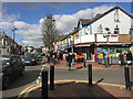
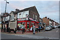
Bustling Bury Park along Dunstable Road, Luton
A shopping and social area for the Pakistani and Afghan communities. I felt like a minority. The busy A505 Dunstable Road connects with the M1 at Junction 11 to the west. The shop Ujan Bhat is on the corner of Waldeck Road.
Image: © Robin Stott
Taken: 24 Feb 2017
0.09 miles
5
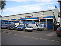
Luton: Kenilworth Road
The Kenilworth Road stand of Luton Town Football Club, at the opposite end of the ground to Image
Image: © Nigel Cox
Taken: 25 Jun 2006
0.11 miles
6
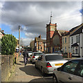
Waldeck Road and Bury Park United Reformed Church, Luton
The church is "1895-1903 by G Baines in neo-decorated and perpendicular style", listed Grade II https://www.historicengland.org.uk/listing/the-list/list-entry/1114638 . A closer but distorted view is Image
Image: © Robin Stott
Taken: 24 Feb 2017
0.12 miles
7
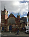
Bury Park United Reformed Church, Waldeck Road, Luton
The church is "1895-1903 by G Baines in neo-decorated and perpendicular style", listed Grade II https://www.historicengland.org.uk/listing/the-list/list-entry/1114638 . The setting is Image
Image: © Robin Stott
Taken: 24 Feb 2017
0.12 miles
9

The Kenilworth Stand at Kenilworth Road
Kenilworth Road is the home of Luton Town F.C.
Image: © Steve Daniels
Taken: 4 May 2019
0.12 miles
10
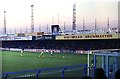
The Bobbers Stand at Kenilworth Road
The stand was demolished in 1986 to make way for executive boxes.
Image: © Steve Daniels
Taken: 2 Sep 1980
0.13 miles