
IMAGES TAKEN NEAR TO
Lavender Walk, LEEDS, LS9 8JB
Introduction
This page details the photographs taken nearby to Lavender Walk, LS9 8JB by members of the Geograph project.
The Geograph project started in 2005 with the aim of publishing, organising and preserving representative images for every square kilometre of Great Britain, Ireland and the Isle of Man.

There are currently over 7.5m images from over14,400 individuals and you can help contribute to the project by visiting https://www.geograph.org.uk
Image Map
Images are licensed for reuse under creativecommons.org/licenses/by-sa/2.0
Notes
- Clicking on the map will re-center to the selected point.
- The higher the marker number, the further away the image location is from the centre of the postcode.
Image Listing (176 Images Found)
Images are licensed for reuse under creativecommons.org/licenses/by-sa/2.0
Image
Details
Distance
3
Country Style Foods, Lavender Walk, Leeds
A bakery products company founded in 1962 http://www.countrystyle.co.uk/history.htm - see also Image
Image: © Stephen Craven
Taken: 12 Feb 2016
0.03 miles
4
Lavender Walk - viewed from Blayds Street
Image: © Betty Longbottom
Taken: 29 May 2013
0.03 miles
5
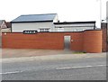
NARLA, Leeds
Narla is an engineering services company, carrying out Metal Finishing. Their address is Danby Walk; this is the rear of the premises on Upper Accommodation Road.
Image: © Stephen Craven
Taken: 12 Feb 2016
0.05 miles
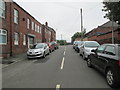
7
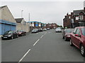
Lavender Walk - Upper Accommodation Road
Image: © Betty Longbottom
Taken: 29 May 2013
0.05 miles
8
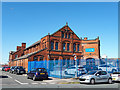
Former school building, Pontefract Lane, Leeds
This building is marked on large scale maps from 1893 to the 1930s as a Sunday School.
If so, it was not related to All Saints church along the road as that had its own adjacent school building. One local history website refers to the Leeds Friends Adult School which moved to Pontefract Lane in 1890, so that might have been its real use - adult education rather than RE for children. But another local website suggests it was a chapel (denomination not stated). After closure it became a sweet warehouse (again according to local people's memories online), and is now part of Country Style Foods who have recently also acquired the (1980s replacement) All Saints church as their training centre.
Image: © Stephen Craven
Taken: 29 Jun 2018
0.05 miles
9
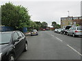
Lavender Walk - viewed from Blayds Street
Image: © Betty Longbottom
Taken: 29 May 2013
0.05 miles
10
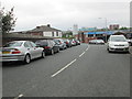
Bridge HUL 4/36 - Upper Accommodation Road
Image: © Betty Longbottom
Taken: 29 May 2013
0.06 miles