
IMAGES TAKEN NEAR TO
Railway Street, LEEDS, LS9 8HB
Introduction
This page details the photographs taken nearby to Railway Street, LS9 8HB by members of the Geograph project.
The Geograph project started in 2005 with the aim of publishing, organising and preserving representative images for every square kilometre of Great Britain, Ireland and the Isle of Man.

There are currently over 7.5m images from over14,400 individuals and you can help contribute to the project by visiting https://www.geograph.org.uk
Image Map
Images are licensed for reuse under creativecommons.org/licenses/by-sa/2.0
Notes
- Clicking on the map will re-center to the selected point.
- The higher the marker number, the further away the image location is from the centre of the postcode.
Image Listing (274 Images Found)
Images are licensed for reuse under creativecommons.org/licenses/by-sa/2.0
Image
Details
Distance
1

Railway Street, Leeds
Photo taken from the bridge seen in Image
Image: © Stephen Craven
Taken: 17 Sep 2015
0.01 miles
2
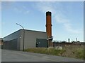
Saxton Gardens Energy Centre
The facility, constructed in 2019, serves as a backup to the Cross Green energy centre serving the East Leeds district heating scheme. supplying hot water to up to 2000 council properties. Source: https://www.leeds-pipes.co.uk/2018/06/saxton-gardens-energy-centre-planning-approved/
The site was formerly occupied by a social club Image
Image: © Stephen Craven
Taken: 29 Jan 2022
0.02 miles
3
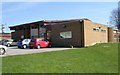
Yorkshire Rider Social Club - Flax Place
Image: © Betty Longbottom
Taken: 31 Mar 2008
0.03 miles
4

Railway approaching Leeds
The Transpennine service seen here alongside Railway Street is passing the site of the original Marsh Lane station which was the first terminus of the Leeds and Selby Railway. Photo taken from the bridge seen in Image
Image: © Stephen Craven
Taken: 17 Sep 2015
0.04 miles
5
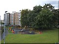
Playground, Railway Street, Leeds
Presumably provided for the children of the Richmond Hill estate in the background.
Image: © Stephen Craven
Taken: 17 Sep 2015
0.04 miles


9

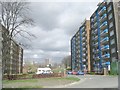
The Garth, Saxton Gardens, Leeds
First approved in 1939 but later abandoned with the outbreak of war. Construction was once again approved by committee in 1955 and the development started in that year.
The blocks were designed by the City Architect, R. A. H. Livett. Seven blocks of flats were built between 1955 and 1957 designed to accommodate up to 1791 residents in one, two and three bedroomed units. The flats were installed with the Garchy System of refuse disposal and the underground suction pipes were linked to the Refuse Disposal Station at Quarry Hill Flats. The buildings were constructed in reinforced concrete with brickwork to the external walls. Six shops and a boiler house were also constructed on the site and a play area was designed for small children. The first of the blocks to be completed was officially opened on 12th November 1957. Recently two of the tower blocks have been redesigned by architects Union North, and marketed by Urban Splash The surrounding landscaping includes allotments, wild flower meadows and an orchard.
Image: © Mark Stevenson
Taken: 29 May 2014
0.06 miles
10

Leeds Marsh Lane Station Entrance
Entrance gate posts to the first railway station in Leeds and Yorkshire, the Leeds & Selby Railway's 1834 Marsh Lane Railway Station.
Image: © Phil Marshall
Taken: 30 Sep 2018
0.06 miles