
IMAGES TAKEN NEAR TO
Appleton Close, LEEDS, LS9 7RT
Introduction
This page details the photographs taken nearby to Appleton Close, LS9 7RT by members of the Geograph project.
The Geograph project started in 2005 with the aim of publishing, organising and preserving representative images for every square kilometre of Great Britain, Ireland and the Isle of Man.

There are currently over 7.5m images from over14,400 individuals and you can help contribute to the project by visiting https://www.geograph.org.uk
Image Map
Images are licensed for reuse under creativecommons.org/licenses/by-sa/2.0
Notes
- Clicking on the map will re-center to the selected point.
- The higher the marker number, the further away the image location is from the centre of the postcode.
Image Listing (78 Images Found)
Images are licensed for reuse under creativecommons.org/licenses/by-sa/2.0
Image
Details
Distance
2

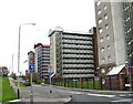
Appleton Way, Leeds
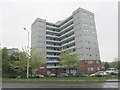
Looking from the junction with Torre Road. The blocks of flats are Appleton Square (nearest), Appleton Close, Appleton Court (furthest). They are part of the Ebor Gardens Estate which was built in 1959. Each block has 10 floors and 60 flats.
Image: © Rich Tea
Taken: 10 Jun 2025
0.02 miles
3
Flats, Leeds
High density housing just east of Leeds city centre.
Image: © Lynne Kirton
Taken: 8 Oct 2005
0.04 miles
8
Block of flats in Burmantofts
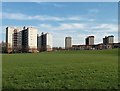
The two T-shaped blocks to the left are Torre Green and Torre Gardens. The three in the distance are Appleton Court, Appleton Close and Saville Green (the latter named after a local road, no longer extant). A fourth, Appleton Square, is hidden behind the Torres.
The grassy area in the foreground does not seem to have a name on modern maps but is part of the site of the former clay pits that served the Burmantofts pottery and brick works. Presumably being landfill is what has prevented it being built on.
Image: © Stephen Craven
Taken: 16 Feb 2016
0.08 miles
10

Walford Road - Glenthorpe Crescent
Image: © Betty Longbottom
Taken: 16 Sep 2013
0.08 miles