IMAGES TAKEN NEAR TO
Gargrave Place, LEEDS, LS9 7HW
Introduction
This page details the photographs taken nearby to Gargrave Place, LS9 7HW by members of the Geograph project.
The Geograph project started in 2005 with the aim of publishing, organising and preserving representative images for every square kilometre of Great Britain, Ireland and the Isle of Man.

There are currently over 7.5m images from over14,400 individuals and you can help contribute to the project by visiting https://www.geograph.org.uk
Image Map
Images are licensed for reuse under creativecommons.org/licenses/by-sa/2.0
Notes
- Clicking on the map will re-center to the selected point.
- The higher the marker number, the further away the image location is from the centre of the postcode.
Image Listing (106 Images Found)
Images are licensed for reuse under creativecommons.org/licenses/by-sa/2.0
Image
Details
Distance
1
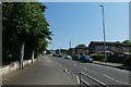
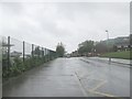
Stoney Rock Lane
Looking along Stoney Rock Lane beside the Co-op Academy.
Image: © DS Pugh
Taken: 10 Jun 2023
0.02 miles
2
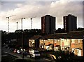
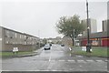
Brignall Garth, Leeds
Residential area close to the centre of Leeds. Shakespeare flats in the background, and the tower cranes are being used in the construction of an addition to St. James's Hospital.
Image: © Lynne Kirton
Taken: 8 Oct 2005
0.05 miles
3
The Kiln - Brignall Garth, Stoney Rock Lane
Image: © Betty Longbottom
Taken: 7 Apr 2008
0.05 miles
4
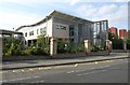
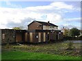
Primrose High School
See also Image; this section of the building can be seen on the right of that image.
Image: © Derek Harper
Taken: 29 Jul 2011
0.05 miles
6
Shakespeare Avenue - Stoney Rock Lane
Image: © Betty Longbottom
Taken: 24 May 2013
0.06 miles
7
Shakespeare Primary School - Stoney Rock Lane
Image: © Betty Longbottom
Taken: 7 Apr 2008
0.06 miles
8
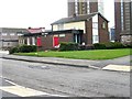
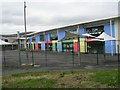
Ayendah Sazan Education Centre
A former pub, already closed by 2013 Image and now an Islamic community education centre. The planning application for change of use is dated October 2015, and it includes this statement: "Ayendah Sazan means ‘good use of time’, relating to the education and training use proposed. The applicants are members of the Hazara community, a minority group from Afghanistan, which came to the UK
from 1999 onwards to escape persecution from the Taliban".
Image: © Stephen Craven
Taken: 26 Mar 2022
0.06 miles
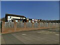
10
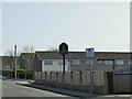
Sign for the former Kiln pub
The John Smith's pub was presumably named due to its proximity to the former Burmantofts pottery factory, and was already closed by 2013 Image The building now hosts the Ayendah Sazan Education Centre Image I didn't photograph the front of the building as there were children around (and it was against the light).
Image: © Stephen Craven
Taken: 26 Mar 2022
0.07 miles