
IMAGES TAKEN NEAR TO
South Accommodation Road, LEEDS, LS9 0RT
Introduction
This page details the photographs taken nearby to South Accommodation Road, LS9 0RT by members of the Geograph project.
The Geograph project started in 2005 with the aim of publishing, organising and preserving representative images for every square kilometre of Great Britain, Ireland and the Isle of Man.

There are currently over 7.5m images from over14,400 individuals and you can help contribute to the project by visiting https://www.geograph.org.uk
Image Map
Images are licensed for reuse under creativecommons.org/licenses/by-sa/2.0
Notes
- Clicking on the map will re-center to the selected point.
- The higher the marker number, the further away the image location is from the centre of the postcode.
Image Listing (69 Images Found)
Images are licensed for reuse under creativecommons.org/licenses/by-sa/2.0
Image
Details
Distance
1
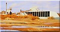
La Farge Tarmac, Cross Green Industrial Estate, Knowsthorpe Lane, Leeds
Image: © Mark Stevenson
Taken: 23 Feb 2015
0.02 miles
2
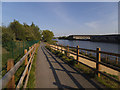
Ramp down from new bridge, Knostrop Cut
Following the completion of flood alleviation works that removed the 'central reservation' between the river and the Navigation, the cycle route (National Cycle Route 67) that used to run along the reservation and that was temporarily diverted round roads on the south bank was reinstated in 2019 along the north bank of the river, with a new bridge at the eastern end and a pair of bridges at the western end. This view shows the full width of the combined channels.
Image: © Stephen Craven
Taken: 14 May 2019
0.14 miles
3

Footbridge across the River Aire
Relatively new construction across the Aire, adopted by the Trans Pennine Trail spur.
The central isle that separated the river from the Aire and Calder Navigation has now been removed, rendering the waterway as one entity.
Image: © Chris Heaton
Taken: 27 Nov 2022
0.15 miles
4

New bridge, Knostrop Cut (2)
Following the completion of flood alleviation works that removed the 'central reservation' between the river and the Navigation, the cycle route that used to run along the reservation and that was temporarily diverted round roads on the south bank was reinstated in 2019 along the north bank of the river, with a new bridge at the eastern end and a pair of bridges at the western end. This is the northern bridge (across the original course of the river) at the western end.
Image: © Stephen Craven
Taken: 14 May 2019
0.15 miles
5

Knostrop Bridge
Crossing the River Aire. The bridge forms part of National Cycle Network route 67.
Image: © DS Pugh
Taken: 26 May 2023
0.15 miles
6

Towards Knostrop Bridge
Looking towards a footbridge over the River Aire.
Image: © DS Pugh
Taken: 26 May 2023
0.15 miles
7
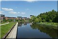
River Aire from Knostrop Bridge
Looking upstream along the river from a footbridge.
Image: © DS Pugh
Taken: 26 May 2023
0.15 miles
8

New planting, Knostrop Cut (1)
Trees planted as part of the reinstatement after flood alleviation works.
Image: © Stephen Craven
Taken: 14 May 2019
0.17 miles
10

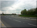
River Aire near Goodman Street
This is just above the point at which the river used to be divided between the navigable "Knowsthorpe Cut" and a non-navigable channel, although the distinction has recently been abolished with the removal of the spit between the two.
Image: © Stephen Craven
Taken: 29 Oct 2016
0.17 miles