IMAGES TAKEN NEAR TO
Vicars Road, LEEDS, LS8 5AS
Introduction
This page details the photographs taken nearby to Vicars Road, LS8 5AS by members of the Geograph project.
The Geograph project started in 2005 with the aim of publishing, organising and preserving representative images for every square kilometre of Great Britain, Ireland and the Isle of Man.

There are currently over 7.5m images from over14,400 individuals and you can help contribute to the project by visiting https://www.geograph.org.uk
Image Map
Images are licensed for reuse under creativecommons.org/licenses/by-sa/2.0
Notes
- Clicking on the map will re-center to the selected point.
- The higher the marker number, the further away the image location is from the centre of the postcode.
Image Listing (300 Images Found)
Images are licensed for reuse under creativecommons.org/licenses/by-sa/2.0
Image
Details
Distance
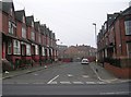
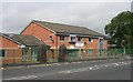
4
Back Hill Top Avenue - Shepherds Lane
Image: © Betty Longbottom
Taken: 31 Dec 2008
0.03 miles
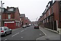
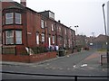
5
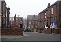
Bangladeshi Community Centre - Roundhay Road
Image: © Betty Longbottom
Taken: 19 Sep 2007
0.03 miles
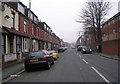
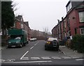
9
Back Alcester Place - Hill Top Avenue
Image: © Betty Longbottom
Taken: 31 Dec 2008
0.05 miles
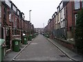
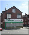
10
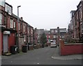
Back Alcester Road - Hill Top Avenue
Image: © Betty Longbottom
Taken: 31 Dec 2008
0.06 miles