IMAGES TAKEN NEAR TO
Gledhow Wood Road, LEEDS, LS8 4DH
Introduction
This page details the photographs taken nearby to Gledhow Wood Road, LS8 4DH by members of the Geograph project.
The Geograph project started in 2005 with the aim of publishing, organising and preserving representative images for every square kilometre of Great Britain, Ireland and the Isle of Man.

There are currently over 7.5m images from over14,400 individuals and you can help contribute to the project by visiting https://www.geograph.org.uk
Image Map
Images are licensed for reuse under creativecommons.org/licenses/by-sa/2.0
Notes
- Clicking on the map will re-center to the selected point.
- The higher the marker number, the further away the image location is from the centre of the postcode.
Image Listing (63 Images Found)
Images are licensed for reuse under creativecommons.org/licenses/by-sa/2.0
Image
Details
Distance
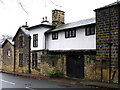
4
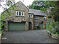
47 Gledhow Wood Road, Leeds
Arts and Crafts in local stone, one of only a few houses achieved as part of a plan by J.S. Brocklesby before the war kiboshed everything in 1914.
Image: © Stephen Richards
Taken: 25 Jul 2017
0.06 miles
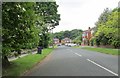
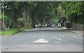
6
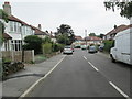
Fitzroy Drive - viewed from Thorn Lane
Image: © Betty Longbottom
Taken: 5 Jun 2013
0.07 miles
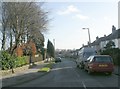
7
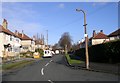
St Margaret's View - Fitzroy Drive
Image: © Betty Longbottom
Taken: 20 Jan 2009
0.07 miles
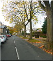
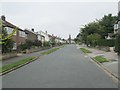
8
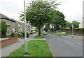
Gledhow Wood Road - viewed from Thorn Lane
Image: © Betty Longbottom
Taken: 5 Jun 2013
0.07 miles
9
Oakwell Avenue - viewed from Dean Avenue
Image: © Betty Longbottom
Taken: 23 Sep 2013
0.08 miles