IMAGES TAKEN NEAR TO
Gipton Wood Road, LEEDS, LS8 3AQ
Introduction
This page details the photographs taken nearby to Gipton Wood Road, LS8 3AQ by members of the Geograph project.
The Geograph project started in 2005 with the aim of publishing, organising and preserving representative images for every square kilometre of Great Britain, Ireland and the Isle of Man.

There are currently over 7.5m images from over14,400 individuals and you can help contribute to the project by visiting https://www.geograph.org.uk
Image Map
Images are licensed for reuse under creativecommons.org/licenses/by-sa/2.0
Notes
- Clicking on the map will re-center to the selected point.
- The higher the marker number, the further away the image location is from the centre of the postcode.
Image Listing (62 Images Found)
Images are licensed for reuse under creativecommons.org/licenses/by-sa/2.0
Image
Details
Distance
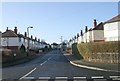
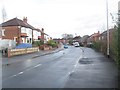
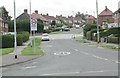
2
Amberton Road - more semi-detached houses
Image: © Malcolm Street
Taken: 12 Nov 2005
0.06 miles
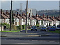
5
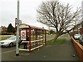
Bus stop on Easterly Road
Served by route 49 to Bramley via the city centre.
Image: © Stephen Craven
Taken: 27 Jan 2018
0.09 miles
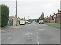
8
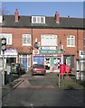
Easterly Road Post Office - Easterly Road
Image: © Betty Longbottom
Taken: 20 Jan 2009
0.11 miles
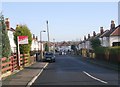
10
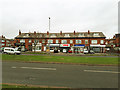
Shops on Easterly Road
Viewed across the dual carriageway (and across a grid line).
Image: © Stephen Craven
Taken: 27 Jan 2018
0.12 miles