IMAGES TAKEN NEAR TO
Thorn Lane, LEEDS, LS8 1NF
Introduction
This page details the photographs taken nearby to Thorn Lane, LS8 1NF by members of the Geograph project.
The Geograph project started in 2005 with the aim of publishing, organising and preserving representative images for every square kilometre of Great Britain, Ireland and the Isle of Man.

There are currently over 7.5m images from over14,400 individuals and you can help contribute to the project by visiting https://www.geograph.org.uk
Image Map (Loading...)


Getting Data...Please wait
Leaflet Map data © OpenStreetMap
Images are licensed for reuse under creativecommons.org/licenses/by-sa/2.0
Notes
- Clicking on the map will re-center to the selected point.
- The higher the marker number, the further away the image location is from the centre of the postcode.
Image Listing (68 Images Found)
Images are licensed for reuse under creativecommons.org/licenses/by-sa/2.0
Image
Details
Distance
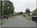
5
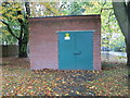
Electricity Substation No 2085 - off Gledhow Lane
Image: © Betty Longbottom
Taken: 22 Oct 2013
0.08 miles
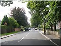
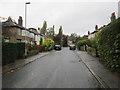
7
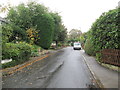
St Margaret's Avenue - St Margaret's View
Image: © Betty Longbottom
Taken: 22 Oct 2013
0.09 miles
8
Driveway to Kerr Mackie Primary School - Gledhow Lane
Image: © Betty Longbottom
Taken: 22 Oct 2013
0.09 miles
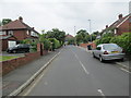
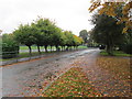
9
St Margaret's Grove - St Margaret's View
Image: © Betty Longbottom
Taken: 22 Oct 2013
0.09 miles
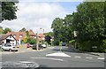
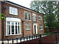
10
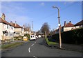
St Margaret's View - Fitzroy Drive
Image: © Betty Longbottom
Taken: 20 Jan 2009
0.10 miles