IMAGES TAKEN NEAR TO
Ingledew Drive, LEEDS, LS8 1DJ
Introduction
This page details the photographs taken nearby to Ingledew Drive, LS8 1DJ by members of the Geograph project.
The Geograph project started in 2005 with the aim of publishing, organising and preserving representative images for every square kilometre of Great Britain, Ireland and the Isle of Man.

There are currently over 7.5m images from over14,400 individuals and you can help contribute to the project by visiting https://www.geograph.org.uk
Image Map
Images are licensed for reuse under creativecommons.org/licenses/by-sa/2.0
Notes
- Clicking on the map will re-center to the selected point.
- The higher the marker number, the further away the image location is from the centre of the postcode.
Image Listing (138 Images Found)
Images are licensed for reuse under creativecommons.org/licenses/by-sa/2.0
Image
Details
Distance
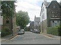
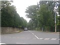
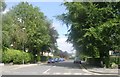
4
Old Park Road - looking towards Street Lane
Image: © Betty Longbottom
Taken: 11 Sep 2013
0.06 miles
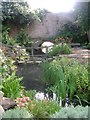
5
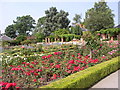
Roundhay Park
Walled Garden outside Tropical World
Image: © Kevin Rushton
Taken: 4 Sep 2005
0.06 miles
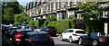
6
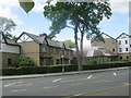
Richmond House Care Home - Street Lane
Image: © Betty Longbottom
Taken: 12 Aug 2009
0.07 miles
8
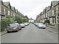
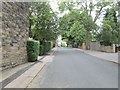
Ingledew Crescent - looking towards Ingledew Drive
Image: © Betty Longbottom
Taken: 11 Sep 2013
0.07 miles
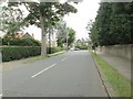
10
Canal Gardens - near Old Park Road Entrance
Image: © Betty Longbottom
Taken: 12 Aug 2009
0.08 miles