IMAGES TAKEN NEAR TO
Harrogate Road, LEEDS, LS7 4LZ

Introduction

This page details the photographs taken nearby to Harrogate Road, LS7 4LZ by members of the Geograph project.

The Geograph project started in 2005 with the aim of publishing, organising and preserving representative images for every square kilometre of Great Britain, Ireland and the Isle of Man.

There are currently over 7.5m images from over14,400 individuals and you can help contribute to the project by visiting https://www.geograph.org.uk

Image Map


Images are licensed for reuse under creativecommons.org/licenses/by-sa/2.0
Notes
  • Clicking on the map will re-center to the selected point.
  • The higher the marker number, the further away the image location is from the centre of the postcode.

Image Listing (271 Images Found)

Images are licensed for reuse under creativecommons.org/licenses/by-sa/2.0
  • ...
Image
Details
Distance
1
Public Library - Harrogate Road
Image: © Betty Longbottom Taken: 16 Oct 2007
0.01 miles
2
Names on Chapel Allerton war memorial
The memorial stands at the entrance to old St Matthew's churchyard Image and is listed grade II (list entry 1256041). The list of names is headed "They battled, they endured, they died".
Image: © Stephen Craven Taken: 30 May 2021
0.01 miles
3
Chapel Allerton war memorial
The memorial stands at the entrance to old St Matthew's churchyard and is listed grade II (list entry 1256041). See the other side at Image
Image: © Stephen Craven Taken: 30 May 2021
0.01 miles
4
Chapel Allerton War Memorial - Harrogate Road
Image: © Betty Longbottom Taken: 16 Oct 2007
0.01 miles
5
Harrogate Road, Chapel Allerton
Image: © Stanley Walker Taken: 16 Jun 2010
0.02 miles
6
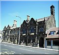
Public Buildings, Chapel Allerton
Built 1904 l/r Police Station,Fire Station,Library
Image: © Stanley Walker Taken: 16 Jun 2010
0.02 miles
7
Shops on Harrogate Road
The road to the left of these buildings is Ingle Row.
Image: © Stephen Craven Taken: 30 May 2021
0.02 miles
8
Ramsons in old St Matthew's churchyard
The old St Matthew's church was replaced on a different site in 1898 but the old church was not demolished until c.1935 (date not yet confirmed - it still appears on the 1938 OS map).
Image: © Stephen Craven Taken: 30 May 2021
0.03 miles
9
Bar on Harrogate Road
At this time the Covid restrictions meant that people could only sit outside bars and restaurants (or in well ventilated structures).
Image: © Stephen Craven Taken: 30 May 2021
0.03 miles
10
Chapel Allerton, Harrogate Road
The benchmark is cut into the roadside wall on the west side of Harrogate Road, and outside the Seven Cafe/Bar.
Image: © Mel Towler Taken: 31 Jan 2023
0.03 miles
  • ...