IMAGES TAKEN NEAR TO
Scott Hall Grove, LEEDS, LS7 3JH
Introduction
This page details the photographs taken nearby to Scott Hall Grove, LS7 3JH by members of the Geograph project.
The Geograph project started in 2005 with the aim of publishing, organising and preserving representative images for every square kilometre of Great Britain, Ireland and the Isle of Man.

There are currently over 7.5m images from over14,400 individuals and you can help contribute to the project by visiting https://www.geograph.org.uk
Image Map (Loading...)


Getting Data...Please wait
Leaflet Map data © OpenStreetMap
Images are licensed for reuse under creativecommons.org/licenses/by-sa/2.0
Notes
- Clicking on the map will re-center to the selected point.
- The higher the marker number, the further away the image location is from the centre of the postcode.
Image Listing (82 Images Found)
Images are licensed for reuse under creativecommons.org/licenses/by-sa/2.0
Image
Details
Distance
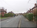
1
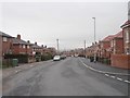
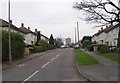
Scott Hall Grove - viewed from Scott Hall Square
Image: © Betty Longbottom
Taken: 29 Jan 2013
0.03 miles
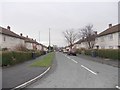
2
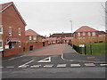
Scott Hall Square - Scott Hall Grove
Image: © Betty Longbottom
Taken: 29 Jan 2013
0.05 miles
3
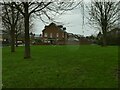
Pocket park on Scott Hall Grove
Unsurprisingly no-one was using it on a wet January afternoon.
Image: © Stephen Craven
Taken: 2 Jan 2022
0.06 miles
4
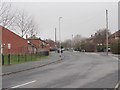
Scott Hall Grove - viewed from Scott Hall Square
Image: © Betty Longbottom
Taken: 29 Jan 2013
0.06 miles
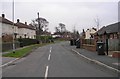
5
Newton Hall Drive - Scott Hall Green
Image: © Betty Longbottom
Taken: 29 Dec 2008
0.06 miles
6
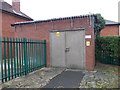
Electricity Substation No 2598 - Scott Hall Terrace
Image: © Betty Longbottom
Taken: 29 Jan 2013
0.07 miles
7
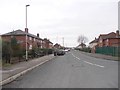
Scott Hall Terrace - Scott Hall Grove
Image: © Betty Longbottom
Taken: 29 Jan 2013
0.07 miles
8
Scott Hall Green - Scott Hall Grove
Image: © Betty Longbottom
Taken: 29 Dec 2008
0.08 miles
9
Scott Hall Avenue - Scott Hall Road
Image: © Betty Longbottom
Taken: 29 Jan 2013
0.08 miles
10
Newton Lodge Drive - St Martin's Avenue
Image: © Betty Longbottom
Taken: 29 Jan 2013
0.09 miles