IMAGES TAKEN NEAR TO
Reginald Terrace, LEEDS, LS7 3EZ
Introduction
This page details the photographs taken nearby to Reginald Terrace, LS7 3EZ by members of the Geograph project.
The Geograph project started in 2005 with the aim of publishing, organising and preserving representative images for every square kilometre of Great Britain, Ireland and the Isle of Man.

There are currently over 7.5m images from over14,400 individuals and you can help contribute to the project by visiting https://www.geograph.org.uk
Image Map
Images are licensed for reuse under creativecommons.org/licenses/by-sa/2.0
Notes
- Clicking on the map will re-center to the selected point.
- The higher the marker number, the further away the image location is from the centre of the postcode.
Image Listing (188 Images Found)
Images are licensed for reuse under creativecommons.org/licenses/by-sa/2.0
Image
Details
Distance
1
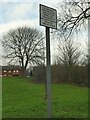
What plan?
This rather odd sign at the entrance to a small urban park on Reginald Terrace reads "The land shown red on the attached plan is private land. Public access to this land is prohibited by order of Leeds City Council". But with no obvious plan in sight how is one to know where the public park stops and private land begins?
Image: © Stephen Craven
Taken: 9 Jan 2022
0.02 miles
2
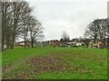
Reginald Park, Chapeltown
An unfenced pocket park with a children's playground. The 1965 map shows this site occupied by housing and a synagogue (built 1938, closed 1973, then used as an ethnic community centre but since demolished, source: http://www.etzchaim.co.uk/history.php )
Image: © Stephen Craven
Taken: 9 Jan 2022
0.03 miles
4
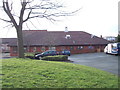
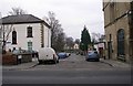
Frederick Hurdle Day Centre - Reginald Terrace
Image: © Betty Longbottom
Taken: 29 Jan 2013
0.06 miles
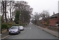
5
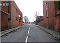
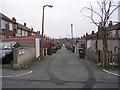
Back Newton Grove - Chapeltown Road
Image: © Betty Longbottom
Taken: 29 Dec 2008
0.07 miles
7

BAME Health and Wellbeing Hub
Previously described as a day centre Image but the two descriptions are not incompatible.
Image: © Stephen Craven
Taken: 9 Jan 2022
0.07 miles
8
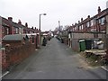
Back Mexborough Grove - Savile Avenue
Image: © Betty Longbottom
Taken: 29 Dec 2008
0.07 miles
9
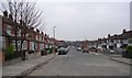
Mexborough Grove - Mexborough Place
Image: © Betty Longbottom
Taken: 29 Dec 2008
0.08 miles
10
Back Mexborough Grove - Mexborough Place
Image: © Betty Longbottom
Taken: 29 Dec 2008
0.08 miles