IMAGES TAKEN NEAR TO
Farm Hill North, LEEDS, LS7 2QE
Introduction
This page details the photographs taken nearby to Farm Hill North, LS7 2QE by members of the Geograph project.
The Geograph project started in 2005 with the aim of publishing, organising and preserving representative images for every square kilometre of Great Britain, Ireland and the Isle of Man.

There are currently over 7.5m images from over14,400 individuals and you can help contribute to the project by visiting https://www.geograph.org.uk
Image Map (Loading...)


Getting Data...Please wait
Leaflet Map data © OpenStreetMap
Images are licensed for reuse under creativecommons.org/licenses/by-sa/2.0
Notes
- Clicking on the map will re-center to the selected point.
- The higher the marker number, the further away the image location is from the centre of the postcode.
Image Listing (92 Images Found)
Images are licensed for reuse under creativecommons.org/licenses/by-sa/2.0
Image
Details
Distance
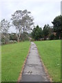
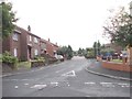
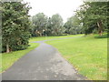
2
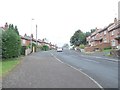
Farm Hill North - viewed from Farm Hill Rise
Image: © Betty Longbottom
Taken: 24 Aug 2012
0.03 miles
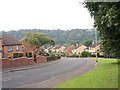
4
Farm Hill North - viewed from Farm Hill Rise
Image: © Betty Longbottom
Taken: 24 Aug 2012
0.04 miles
6
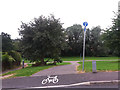
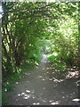
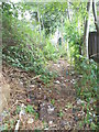
Cycle way off Farm Hill Rise
The Alwoodley cycle path runs through the Farm Hill estate, that takes its name from the Model Farm nearby. See also Image
Image: © Stephen Craven
Taken: 21 Jul 2016
0.06 miles