IMAGES TAKEN NEAR TO
Bowood Crescent, LEEDS, LS7 2PY
Introduction
This page details the photographs taken nearby to Bowood Crescent, LS7 2PY by members of the Geograph project.
The Geograph project started in 2005 with the aim of publishing, organising and preserving representative images for every square kilometre of Great Britain, Ireland and the Isle of Man.

There are currently over 7.5m images from over14,400 individuals and you can help contribute to the project by visiting https://www.geograph.org.uk
Image Map (Loading...)


Getting Data...Please wait
Leaflet Map data © OpenStreetMap
Images are licensed for reuse under creativecommons.org/licenses/by-sa/2.0
Notes
- Clicking on the map will re-center to the selected point.
- The higher the marker number, the further away the image location is from the centre of the postcode.
Image Listing (81 Images Found)
Images are licensed for reuse under creativecommons.org/licenses/by-sa/2.0
Image
Details
Distance
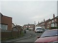
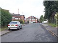
6
Beckhill Approach - Stainbeck Road
Image: © Betty Longbottom
Taken: 27 Jan 2009
0.05 miles
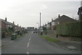
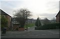
7
Beckhill Approach - Stainbeck Road
Image: © Betty Longbottom
Taken: 24 Aug 2012
0.06 miles
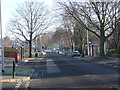
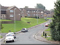
9
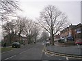
Stainbeck Road - viewed from Stainbeck Avenue
Image: © Betty Longbottom
Taken: 27 Jan 2009
0.07 miles
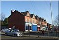
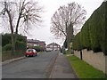
10
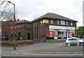
Sainsbury's Local Store - Stainbeck Road
The building at the side looks rather as though it might have been a telephone exchange.
Image: © Betty Longbottom
Taken: 29 Apr 2008
0.07 miles