IMAGES TAKEN NEAR TO
Woodlea Grove, LEEDS, LS6 4SJ
Introduction
This page details the photographs taken nearby to Woodlea Grove, LS6 4SJ by members of the Geograph project.
The Geograph project started in 2005 with the aim of publishing, organising and preserving representative images for every square kilometre of Great Britain, Ireland and the Isle of Man.

There are currently over 7.5m images from over14,400 individuals and you can help contribute to the project by visiting https://www.geograph.org.uk
Image Map
Images are licensed for reuse under creativecommons.org/licenses/by-sa/2.0
Notes
- Clicking on the map will re-center to the selected point.
- The higher the marker number, the further away the image location is from the centre of the postcode.
Image Listing (76 Images Found)
Images are licensed for reuse under creativecommons.org/licenses/by-sa/2.0
Image
Details
Distance
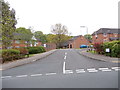
1
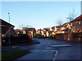
Housing Estate off Tongue Lane
Built on the grounds of Meanwood Park Hospital.
Image: © Chris Heaton
Taken: 19 Dec 2005
0.02 miles
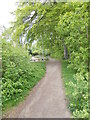
4
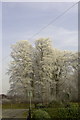
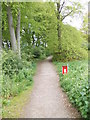
Woodlea Park, Meanwood.
Frozen trees on Woodlea Estate, Far Meanwood.
Image: © Martin Rankin
Taken: 20 Feb 2008
0.04 miles
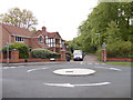
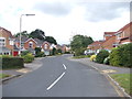
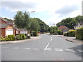
8
Tongue Lane - viewed from Woodlea Park
Image: © Betty Longbottom
Taken: 21 May 2012
0.09 miles
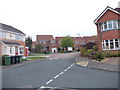
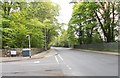
10
Woodlea Approach - Woodlea Gardens
Image: © Betty Longbottom
Taken: 19 Jun 2012
0.09 miles