IMAGES TAKEN NEAR TO
Holmwood Grove, LEEDS, LS6 4NQ
Introduction
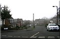
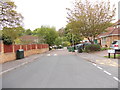
This page details the photographs taken nearby to Holmwood Grove, LS6 4NQ by members of the Geograph project.
The Geograph project started in 2005 with the aim of publishing, organising and preserving representative images for every square kilometre of Great Britain, Ireland and the Isle of Man.

There are currently over 7.5m images from over14,400 individuals and you can help contribute to the project by visiting https://www.geograph.org.uk
Image Map
Images are licensed for reuse under creativecommons.org/licenses/by-sa/2.0
Notes
- Clicking on the map will re-center to the selected point.
- The higher the marker number, the further away the image location is from the centre of the postcode.
Image Listing (70 Images Found)
Images are licensed for reuse under creativecommons.org/licenses/by-sa/2.0
Image
Details
Distance
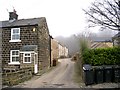
7
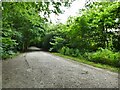
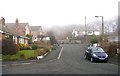
Path in the woods off Parkside
The path gives access into woods that surround the housing estate that now occupies most of the grounds of the former Meanwood Hall.
Image: © Stephen Craven
Taken: 27 Jul 2024
0.07 miles
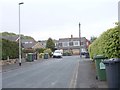
8
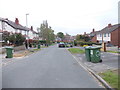
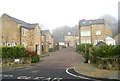
Parkside View - looking towards Church Lane
Image: © Betty Longbottom
Taken: 21 May 2012
0.08 miles