IMAGES TAKEN NEAR TO
Estcourt Avenue, LEEDS, LS6 3ET
Introduction
This page details the photographs taken nearby to Estcourt Avenue, LS6 3ET by members of the Geograph project.
The Geograph project started in 2005 with the aim of publishing, organising and preserving representative images for every square kilometre of Great Britain, Ireland and the Isle of Man.

There are currently over 7.5m images from over14,400 individuals and you can help contribute to the project by visiting https://www.geograph.org.uk
Image Map
Images are licensed for reuse under creativecommons.org/licenses/by-sa/2.0
Notes
- Clicking on the map will re-center to the selected point.
- The higher the marker number, the further away the image location is from the centre of the postcode.
Image Listing (226 Images Found)
Images are licensed for reuse under creativecommons.org/licenses/by-sa/2.0
Image
Details
Distance
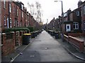
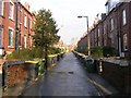
2
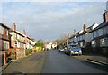
Back Headingley Mount - Canterbury Drive
Image: © Betty Longbottom
Taken: 2 Jan 2009
0.03 miles
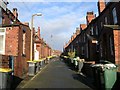
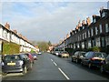
3
Headingley Mount - viewed from Canterbury Drive
Image: © Betty Longbottom
Taken: 2 Jan 2009
0.03 miles
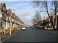
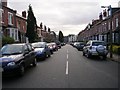
4
Canterbury Drive - viewed from Headingley Mount
Image: © Betty Longbottom
Taken: 2 Jan 2009
0.03 miles
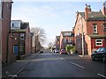
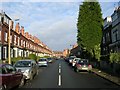
5
Back Headingley Avenue - Canterbury Drive
Image: © Betty Longbottom
Taken: 2 Jan 2009
0.03 miles
8
Headingley Avenue - Canterbury Drive
Image: © Betty Longbottom
Taken: 2 Jan 2009
0.04 miles
9
Estcourt Terrace - Canterbury Drive
Image: © Betty Longbottom
Taken: 2 Jan 2009
0.04 miles
10
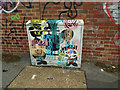
Painted cabinet on Ash Road
This design, more abstract than some of the others, adorns a BT cabinet.
Image: © Stephen Craven
Taken: 3 Jul 2020
0.04 miles