
IMAGES TAKEN NEAR TO
St. Michaels Terrace, LEEDS, LS6 3BQ
Introduction
This page details the photographs taken nearby to St. Michaels Terrace, LS6 3BQ by members of the Geograph project.
The Geograph project started in 2005 with the aim of publishing, organising and preserving representative images for every square kilometre of Great Britain, Ireland and the Isle of Man.

There are currently over 7.5m images from over14,400 individuals and you can help contribute to the project by visiting https://www.geograph.org.uk
Image Map
Images are licensed for reuse under creativecommons.org/licenses/by-sa/2.0
Notes
- Clicking on the map will re-center to the selected point.
- The higher the marker number, the further away the image location is from the centre of the postcode.
Image Listing (347 Images Found)
Images are licensed for reuse under creativecommons.org/licenses/by-sa/2.0
Image
Details
Distance
1
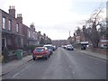
St Michael's Terrace - viewed from Bennett Road
Image: © Betty Longbottom
Taken: 21 Feb 2012
0.03 miles
2
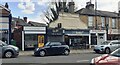
Shops on SE side of North Lane
The shop, GLAMHQ, with the yellow door has an Ordnance Survey benchmark Image on its left hand side, just through a metal gate
Image: © Roger Templeman
Taken: 11 Apr 2023
0.04 miles
3
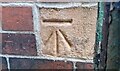
Benchmark on NE face of #19A North Lane
Ordnance Survey cut mark benchmark levelled at 83.619m above Newlyn Datum verified 1957
Image: © Roger Templeman
Taken: 11 Apr 2023
0.04 miles
4
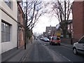
Bennett Road - viewed from St Michael's Terrace
Image: © Betty Longbottom
Taken: 21 Feb 2012
0.04 miles
5

Montgomery House, Bennett Road, Headingley
The building, which is now an 'apart-hotel', is subtitled 'The Old Police Station which is how it is labelled on the 1908 OS 25-inch map. By 1938 it is labelled as a library.
Image: © Stephen Craven
Taken: 30 Mar 2026
0.05 miles
6

Facade of the former Lounge Cinema, Headingley
The cinema on North Lane was built in 1916 and eventually closed in 2005 Image Source: https://cinematreasures.org/theaters/3667. Only the white faience facade remains of the original. The replacement building has a Thai cafe and a Sainsbury's Local convenience store on the ground floor, while upstairs are apartments.
Image: © Stephen Craven
Taken: 30 Mar 2026
0.05 miles
7
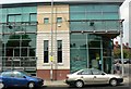
Trio, 44 North Lane, Headingley
To quote from their website "In the day Trio offers a bright decorative restaurant in a relaxing atmosphere. This, combined with the extensive menu makes Trio an ideal place for lunch. During the night the restaurant's lights dim as it transforms into a stylish busy night spot, with the windowed wall creating a superb surrounding."
Image: © Rich Tea
Taken: 12 May 2006
0.05 miles
8
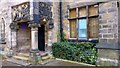
Bennett Road, Headingley, Leeds
Originally meeting rooms for St Michael's parish church, Headingley built 1877 by George Corson.
Image: © Mark Stevenson
Taken: 5 Apr 2016
0.05 miles
9
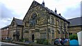
Bennett Road, Headingley, Leeds
Originally meeting rooms for St Michael's parish church, Headingley built 1877 by George Corson.
Image: © Mark Stevenson
Taken: 5 Apr 2016
0.05 miles
10
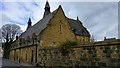
Bennett Road, Headingley, Leeds
This old pumping station was, built in 1879 for Leeds Corporation Waterworks
Image: © Mark Stevenson
Taken: 5 Apr 2016
0.05 miles