IMAGES TAKEN NEAR TO
Kirkstall Lane, LEEDS, LS5 3LF

Introduction

This page details the photographs taken nearby to Kirkstall Lane, LS5 3LF by members of the Geograph project.

The Geograph project started in 2005 with the aim of publishing, organising and preserving representative images for every square kilometre of Great Britain, Ireland and the Isle of Man.

There are currently over 7.5m images from over14,400 individuals and you can help contribute to the project by visiting https://www.geograph.org.uk

Image Map


Images are licensed for reuse under creativecommons.org/licenses/by-sa/2.0
Notes
  • Clicking on the map will re-center to the selected point.
  • The higher the marker number, the further away the image location is from the centre of the postcode.

Image Listing (236 Images Found)

Images are licensed for reuse under creativecommons.org/licenses/by-sa/2.0
  • ...
Image
Details
Distance
1
Modern flats on Kirkstall Lane
Two three-storey blocks of flats.
Image: © Stephen Craven Taken: 7 Apr 2020
0.01 miles
2
Space Invaders, Kirkstall Hill, Headingley
One of the many designs now adorning utility cabinets around this part of Leeds. See Image for context.
Image: © Stephen Craven Taken: 12 Jul 2020
0.01 miles
3
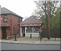
Sandwich Shop - Kirkstall Lane
Image: © Betty Longbottom Taken: 31 Oct 2011
0.01 miles
4
Station Diner, Kirkstall Lane
The sandwich shop has changed its name since 2011, see Image
Image: © Stephen Craven Taken: 7 Apr 2020
0.02 miles
5
Oakfield House - Kirkstall Lane
Converted into flats.
Image: © Betty Longbottom Taken: 26 Nov 2007
0.02 miles
6
The Paxton Horticultural Society, Kirkstall Lane
A charitable organisation for gardeners, occupying a 1960s building in Headingley. See their website for more history: https://sites.google.com/site/paxtonhorticulturalsocietycouk/ Ordinary daffodils were the only flowers in evidence on this occasion.
Image: © Stephen Craven Taken: 7 Apr 2020
0.03 miles
7
Plastic tunnels on allotments, Headingley
Looking across the railway cutting to the allotments on the north side, which have several plastic tunnels on them. Queenswood Drive in the background.
Image: © Rich Tea Taken: 11 Apr 2006
0.03 miles
8
Footpath between Kirkstall Lane and Headingley Station
This footpath runs behind the buildings on Kirkstall Lane. The spire of St Stephen's church above the buildings.
Image: © Rich Tea Taken: 11 Apr 2006
0.03 miles
9
Footpath by railway cutting, Headingley
This footpath runs behind the houses on Kirkstall Lane, towards the station. The railway cutting is behind the fence on the right.
Image: © Rich Tea Taken: 11 Apr 2006
0.04 miles
10
Oakfield House, Kirkstall Lane
Oakfield is a Victorian villa, converted into leasehold flats. See also Image
Image: © Stephen Craven Taken: 7 Apr 2020
0.04 miles
  • ...