IMAGES TAKEN NEAR TO
Belle Vue Road, LEEDS, LS3 1HG
Introduction
This page details the photographs taken nearby to Belle Vue Road, LS3 1HG by members of the Geograph project.
The Geograph project started in 2005 with the aim of publishing, organising and preserving representative images for every square kilometre of Great Britain, Ireland and the Isle of Man.

There are currently over 7.5m images from over14,400 individuals and you can help contribute to the project by visiting https://www.geograph.org.uk
Image Map
Images are licensed for reuse under creativecommons.org/licenses/by-sa/2.0
Notes
- Clicking on the map will re-center to the selected point.
- The higher the marker number, the further away the image location is from the centre of the postcode.
Image Listing (231 Images Found)
Images are licensed for reuse under creativecommons.org/licenses/by-sa/2.0
Image
Details
Distance
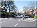
3
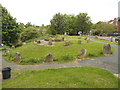
Stone circle off Rosebank Road
There's nothing druidic about this, it's just a landscaping feature where old terraced houses have been demolished.
Image: © Stephen Craven
Taken: 17 May 2019
0.04 miles
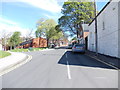
5
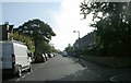
Belle Vue Road - viewed from Woodsley Road
Image: © Betty Longbottom
Taken: 30 Apr 2012
0.05 miles
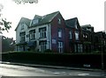
9
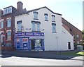
Woodsley Food Store - Woodsley Road
Image: © Betty Longbottom
Taken: 30 Apr 2012
0.06 miles
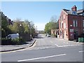
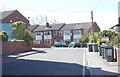
10
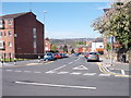
Woodsley Road - viewed from Belle Vue Road
Image: © Betty Longbottom
Taken: 30 Apr 2012
0.06 miles