IMAGES TAKEN NEAR TO
Westwood Rise, ILKLEY, LS29 9SW
Introduction
This page details the photographs taken nearby to Westwood Rise, LS29 9SW by members of the Geograph project.
The Geograph project started in 2005 with the aim of publishing, organising and preserving representative images for every square kilometre of Great Britain, Ireland and the Isle of Man.

There are currently over 7.5m images from over14,400 individuals and you can help contribute to the project by visiting https://www.geograph.org.uk
Image Map
Images are licensed for reuse under creativecommons.org/licenses/by-sa/2.0
Notes
- Clicking on the map will re-center to the selected point.
- The higher the marker number, the further away the image location is from the centre of the postcode.
Image Listing (45 Images Found)
Images are licensed for reuse under creativecommons.org/licenses/by-sa/2.0
Image
Details
Distance
1
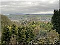
North of Westwood Drive, Ilkley
With westwards view along Wharfedale
Image: © Neil Theasby
Taken: 14 Sep 2015
0.06 miles
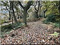
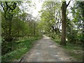
2
Tree on a rock, Ilkley
Next to a path in the Panorama Rocks woodland. Presumably the tree seed must have germinated in a crack in the rock, and the roots somehow made contact with the ground eventually.
Image: © Humphrey Bolton
Taken: 28 Apr 2010
0.09 miles
3
View to Beamsley Beacon from the end of Queens Drive Lane
Image: © Mrs W J Sutherland
Taken: 17 Feb 2024
0.11 miles
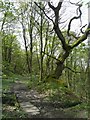
4
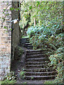
Steps at edge of Panorama Woods, Ilkley
The footpath at the eastern edge of Panorama Woods largely consists of old stone steps. Here we see the steps part way up, at the end of Queens Drive Lane.
Image: © David Spencer
Taken: 29 Sep 2005
0.13 miles
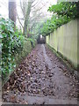
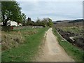
5
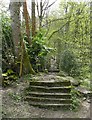
The path up to the moor from Queen's Drive, Ilkley
Punctuated by short flights of rather steep steps.
Image: © Humphrey Bolton
Taken: 28 Apr 2010
0.13 miles
6
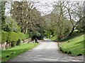
Queen's Drive, Ilkley
This changes its name to Hollin Hall Drive at the foot of the footpath up to the moor.
Image: © Humphrey Bolton
Taken: 28 Apr 2010
0.13 miles
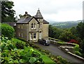
7
Hollin Hall Drive, Ilkley
This presumably led to Hollin Hall, the home of the Heber family in the 18C and 19C, but I couldn't find it the OS map so perhaps it has been demolished.
Image: © Humphrey Bolton
Taken: 28 Apr 2010
0.13 miles
8
Path along the edge of Ilkley Moor
This is part of the Millennium Way.
Image: © Humphrey Bolton
Taken: 28 Apr 2010
0.14 miles