IMAGES TAKEN NEAR TO
Bradford Road, ILKLEY, LS29 7QW
Introduction
This page details the photographs taken nearby to Bradford Road, LS29 7QW by members of the Geograph project.
The Geograph project started in 2005 with the aim of publishing, organising and preserving representative images for every square kilometre of Great Britain, Ireland and the Isle of Man.

There are currently over 7.5m images from over14,400 individuals and you can help contribute to the project by visiting https://www.geograph.org.uk
Image Map (Loading...)


Getting Data...Please wait
Leaflet Map data © OpenStreetMap
Images are licensed for reuse under creativecommons.org/licenses/by-sa/2.0
Notes
- Clicking on the map will re-center to the selected point.
- The higher the marker number, the further away the image location is from the centre of the postcode.
Image Listing (31 Images Found)
Images are licensed for reuse under creativecommons.org/licenses/by-sa/2.0
Image
Details
Distance
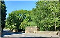
2
Remains of Railway Bridge
The remains of the bridge that brought the Menston - Otley line over the Bradford Rd.
Viewed from this point, the line curved left towards Menston station.
Image: © Isambard K Brunel
Taken: 28 Dec 2011
0.11 miles
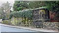
4
Menston, A65, disused railway bridge parapet
There is a benchmark cut into the disused railway bridge parapet on the east side of A65.
Image: © Mel Towler
Taken: 12 Aug 2022
0.13 miles
5
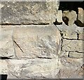
Menstone, A65, bridge parapet
The benchmark is cut into a disused railway bridge parapet and it is on the east side of A65.
Image: © Mel Towler
Taken: 12 Aug 2022
0.13 miles
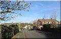
7
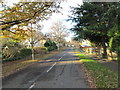
Menston Old Lane - viewed from Endor Crescent
Image: © Betty Longbottom
Taken: 25 Nov 2013
0.14 miles
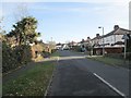
8
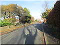
View north-east from outside Menston
Image: © Stephen Craven
Taken: 30 Dec 2020
0.16 miles
9
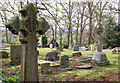
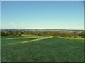
God's Acre Cemetery
This looks like it may be a Victorian municipal graveyard. Its name is "God's Acre Cemetery" and it is situated just north of Menston beside the former path of the old railway line which used to connect Otley to Burley via Milnerwood Junction.
Image: © Tom Blackwell
Taken: 15 Apr 2009
0.18 miles
10
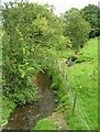
Stream - Bradford Road, Burley in Wharfedale
Image: © Betty Longbottom
Taken: 15 Aug 2008
0.18 miles