IMAGES TAKEN NEAR TO
Greenhow Park, ILKLEY, LS29 7LZ
Introduction
This page details the photographs taken nearby to Greenhow Park, LS29 7LZ by members of the Geograph project.
The Geograph project started in 2005 with the aim of publishing, organising and preserving representative images for every square kilometre of Great Britain, Ireland and the Isle of Man.

There are currently over 7.5m images from over14,400 individuals and you can help contribute to the project by visiting https://www.geograph.org.uk
Image Map (Loading...)


Getting Data...Please wait
Leaflet Map data © OpenStreetMap
Images are licensed for reuse under creativecommons.org/licenses/by-sa/2.0
Notes
- Clicking on the map will re-center to the selected point.
- The higher the marker number, the further away the image location is from the centre of the postcode.
Image Listing (50 Images Found)
Images are licensed for reuse under creativecommons.org/licenses/by-sa/2.0
Image
Details
Distance
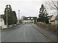
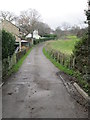
1
Greenhow Park - looking towards Sun Lane
Image: © Betty Longbottom
Taken: 5 Mar 2014
0.02 miles
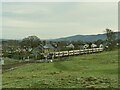
2
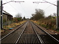
Wharfe Valley Railway Line near Burley
A bridleway crosses the railway line at this point, just outside Burley in Wharfedale
Image: © Chris Heaton
Taken: 4 Dec 2012
0.05 miles
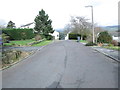
5
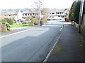
Hall Rise - looking towards Hall Drive
Image: © Betty Longbottom
Taken: 5 Mar 2014
0.07 miles
7
Train between Ben Rhydding and Burley-in-Wharfedale
A class 331 electric unit operating the 12.10 Ilkley to Leeds service passes the level crossing on the edge of Burley.
Image: © Stephen Craven
Taken: 30 Dec 2020
0.07 miles
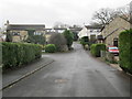
8
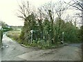
Path junction on Sun Lane
Both branches bear the name Sun Lane; the branch to the right is a public footpath and to the right is a bridleway.
Image: © Stephen Craven
Taken: 30 Dec 2020
0.07 miles
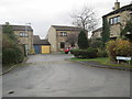
9
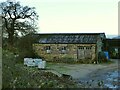
Buildings off Sun Lane
The nearer building is probably a former agricultural one, but further buildings have been erected behind and it seems to be used by a vehicle maintenance business of some kind.
Image: © Stephen Craven
Taken: 30 Dec 2020
0.08 miles