IMAGES TAKEN NEAR TO
Manse Crescent, ILKLEY, LS29 7LA
Introduction
This page details the photographs taken nearby to Manse Crescent, LS29 7LA by members of the Geograph project.
The Geograph project started in 2005 with the aim of publishing, organising and preserving representative images for every square kilometre of Great Britain, Ireland and the Isle of Man.

There are currently over 7.5m images from over14,400 individuals and you can help contribute to the project by visiting https://www.geograph.org.uk
Image Map (155 Images)


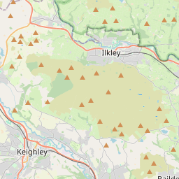

Leaflet Map data © OpenStreetMap
Images are licensed for reuse under creativecommons.org/licenses/by-sa/2.0
Notes
- Clicking on the map will re-center to the selected point.
- The higher the marker number, the further away the image location is from the centre of the postcode.
Image Listing (155 Images Found)
Images are licensed for reuse under creativecommons.org/licenses/by-sa/2.0
Image
Details
Distance
3
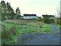
Small enclosed green space
A roughly triangular area between the back gardens of Midgley Road and Manse Crescent.
Image: © Stephen Craven
Taken: 30 Dec 2020
0.02 miles
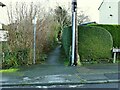
6
Water valve marker
BV is not a common abbreviation on these markers. "Bypass valve" is a possibility but only on large diameter mains (this one is shown as 100mm), and then you would expect to see SV (stop valve) as well. "Boundary valve" is another possibility, i.e. a valve connecting two distribution zones that is normally kept closed but can be opened in an emergency.
Image: © Stephen Craven
Taken: 30 Dec 2020
0.04 miles
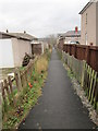
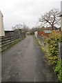
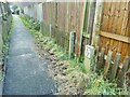
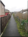
8
Path east of Midgley Road
One of a series of short urban paths between roads that collectively replace (though not exactly on the same alignment) an earlier field path.
Image: © Stephen Craven
Taken: 30 Dec 2020
0.05 miles
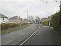
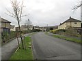
10
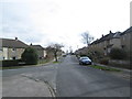
Aireville Terrace - looking towards Station Road
Image: © Betty Longbottom
Taken: 5 Mar 2014
0.05 miles