IMAGES TAKEN NEAR TO
Scalebor Gardens, ILKLEY, LS29 7BX
Introduction
This page details the photographs taken nearby to Scalebor Gardens, LS29 7BX by members of the Geograph project.
The Geograph project started in 2005 with the aim of publishing, organising and preserving representative images for every square kilometre of Great Britain, Ireland and the Isle of Man.

There are currently over 7.5m images from over14,400 individuals and you can help contribute to the project by visiting https://www.geograph.org.uk
Image Map
Images are licensed for reuse under creativecommons.org/licenses/by-sa/2.0
Notes
- Clicking on the map will re-center to the selected point.
- The higher the marker number, the further away the image location is from the centre of the postcode.
Image Listing (61 Images Found)
Images are licensed for reuse under creativecommons.org/licenses/by-sa/2.0
Image
Details
Distance
1
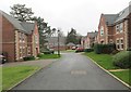
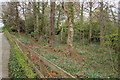
Donald Aldred Drive - looking towards William Fison Ride
Image: © Betty Longbottom
Taken: 9 Dec 2013
0.04 miles
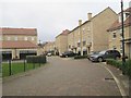
2
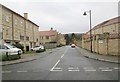
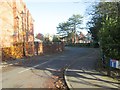
John Gilmour Way - Ron Lawton Crescent
Image: © Betty Longbottom
Taken: 9 Dec 2013
0.05 miles
3
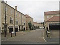
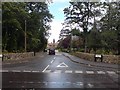
Scalebor Square - Ron Lawton Crescent
Image: © Betty Longbottom
Taken: 9 Dec 2013
0.07 miles
4
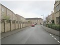
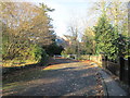
John Gilmour Way - viewed from William Fison Ride
Image: © Betty Longbottom
Taken: 9 Dec 2013
0.07 miles
5
Woodland Daffodils
Entrance to Moor Lane Centre, Burley-in-Wharfedale
Image: © John Sparshatt
Taken: 8 Apr 2008
0.07 miles
6
Donald Aldred Drive - William Fison Ride
Image: © Betty Longbottom
Taken: 25 Nov 2013
0.07 miles
7
William Fison Ride & former Scalebor Hospital
Image: © Rich Tea
Taken: 13 Aug 2007
0.08 miles
9
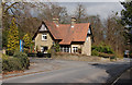
Lodge House
Moor Lane, Burley-in-Wharfedale
Image: © John Sparshatt
Taken: 8 Apr 2008
0.08 miles
10
Scalebor Square - Ron Lawton Crescent
Image: © Betty Longbottom
Taken: 9 Dec 2013
0.09 miles