
IMAGES TAKEN NEAR TO
Colston Drive, ILKLEY, LS29 7BJ
Introduction
This page details the photographs taken nearby to Colston Drive, LS29 7BJ by members of the Geograph project.
The Geograph project started in 2005 with the aim of publishing, organising and preserving representative images for every square kilometre of Great Britain, Ireland and the Isle of Man.

There are currently over 7.5m images from over14,400 individuals and you can help contribute to the project by visiting https://www.geograph.org.uk
Image Map
Images are licensed for reuse under creativecommons.org/licenses/by-sa/2.0
Notes
- Clicking on the map will re-center to the selected point.
- The higher the marker number, the further away the image location is from the centre of the postcode.
Image Listing (6 Images Found)
Images are licensed for reuse under creativecommons.org/licenses/by-sa/2.0
Image
Details
Distance
1
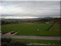
Wharfedale from Audley Clevedon
A view of Wharfedale looking East from Audley Clevedon Retirement Village.
The height to the right of the photograph is of Otley Chevin with Otley in the valley below.
On the far left horizon to the right of the wood is Almscliffe Cragg a well known local rock outcrop.
Image: © Bill Johnson
Taken: 11 Oct 2011
0.07 miles
2

Stone stile
On the footpath to Burley-in-Wharfedale.
Image: © Stephen Craven
Taken: 30 Dec 2020
0.14 miles
3

Walking across a frosty field
On the footpath to Burley-in-Wharfedale.
Image: © Stephen Craven
Taken: 30 Dec 2020
0.17 miles
4
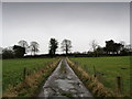
Track near Stead
Track followed during a winter walk to the west of Burley in Wharfedale
Image: © Chris Heaton
Taken: 4 Dec 2012
0.18 miles
5

A muddy gateway
On the footpath from Burley-in-Wharfedale to Ben Rhydding.
Image: © Stephen Craven
Taken: 30 Dec 2020
0.25 miles
6
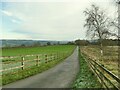
Road to Low House Farm
The road is also a public footpath up to just before the woods in the distance.
Image: © Stephen Craven
Taken: 30 Dec 2020
0.25 miles